Explore
Wilsons Promontory National Park
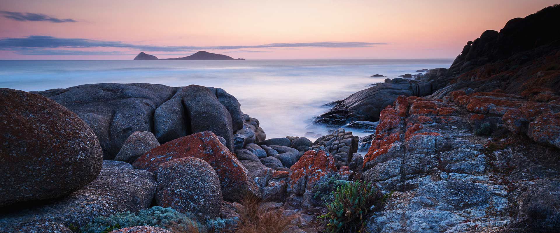
Welcome to Wilsons Prom, the southernmost tip of mainland Australia. Walk remote coastal bushland trails and swim at pristine beaches dominated by granite tors. Camp in comfort at family-friendly Tidal River or hike to a more secluded campsite. Either way, the local wombats, kangaroos and emus are waiting to meet you.
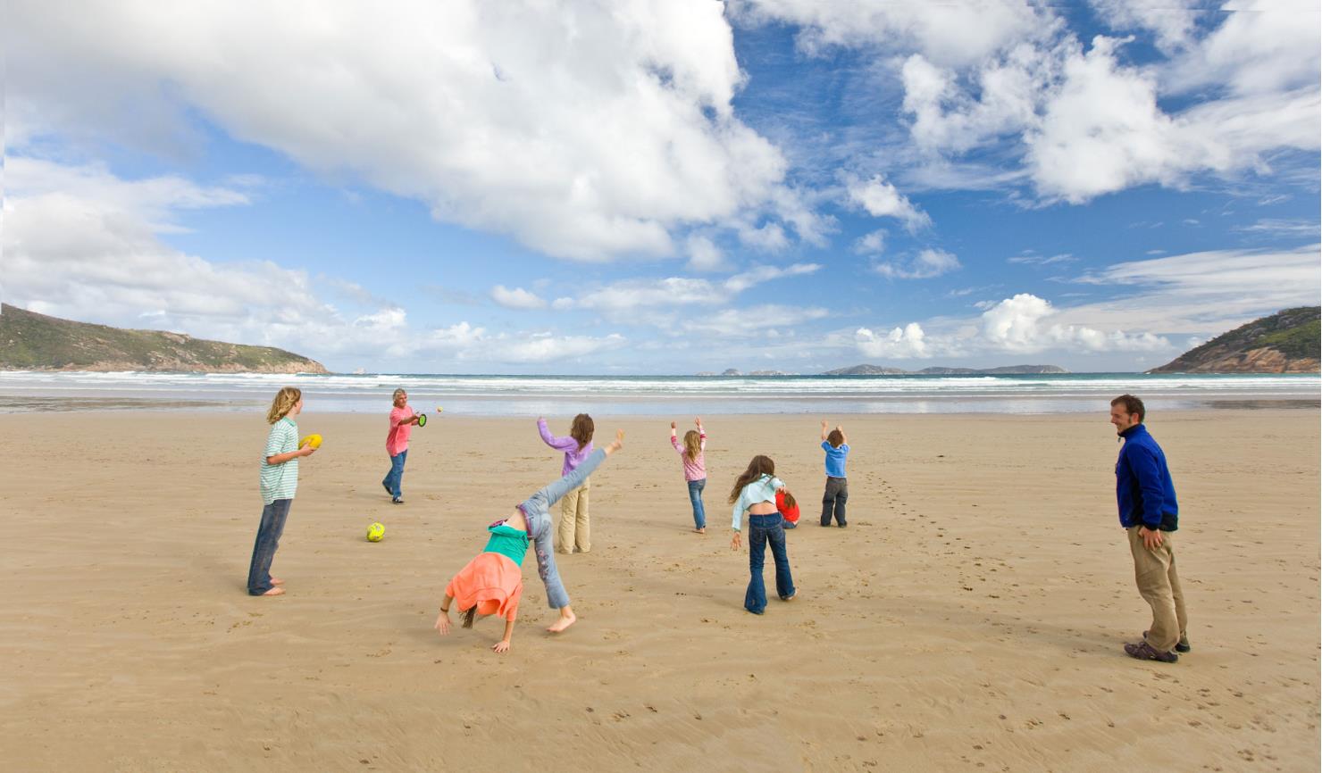
Swim at Norman Beach - just a few minutes' walk from Tidal River Campground, or go snorkelling for a unique underwater view of Victoria's largest marine national park. Bring the family and camp in comfort at Tidal River. Choose from powered or unpowered sites or stay in roofed accommodation.
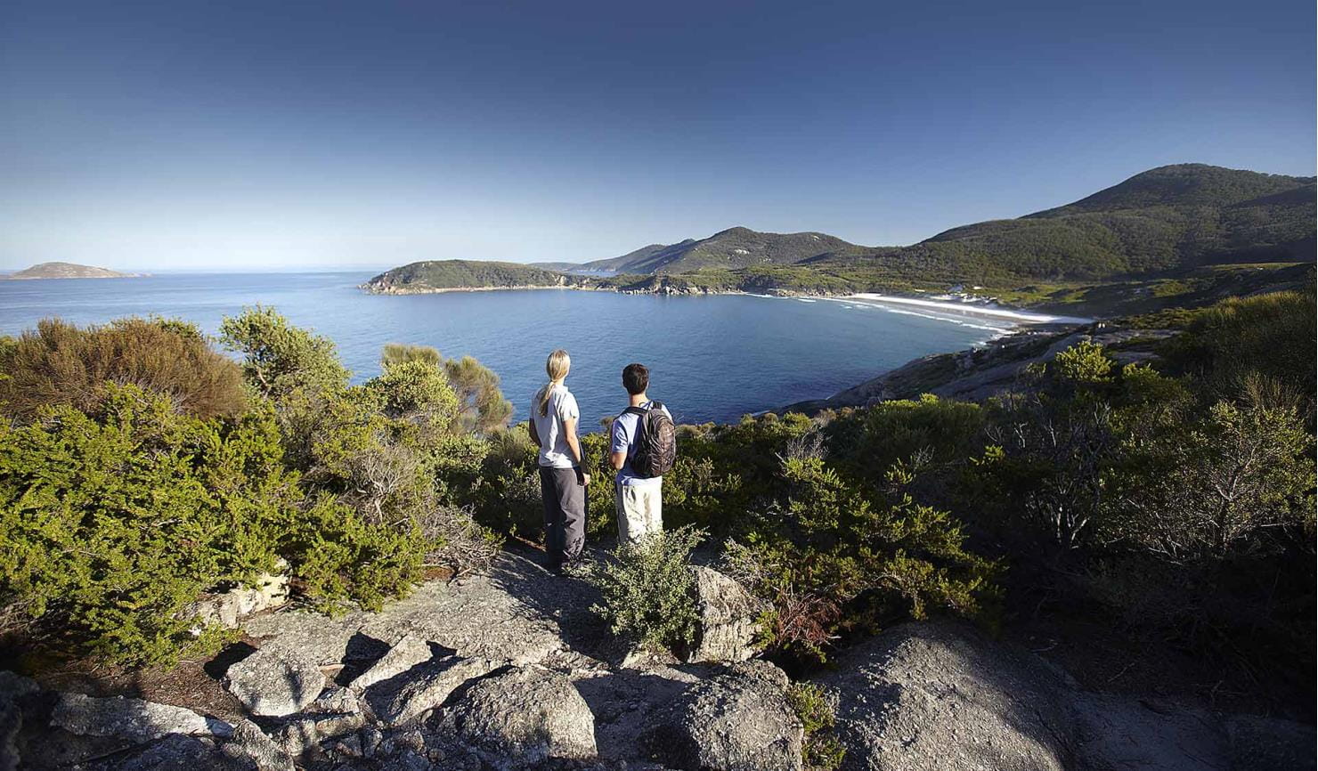
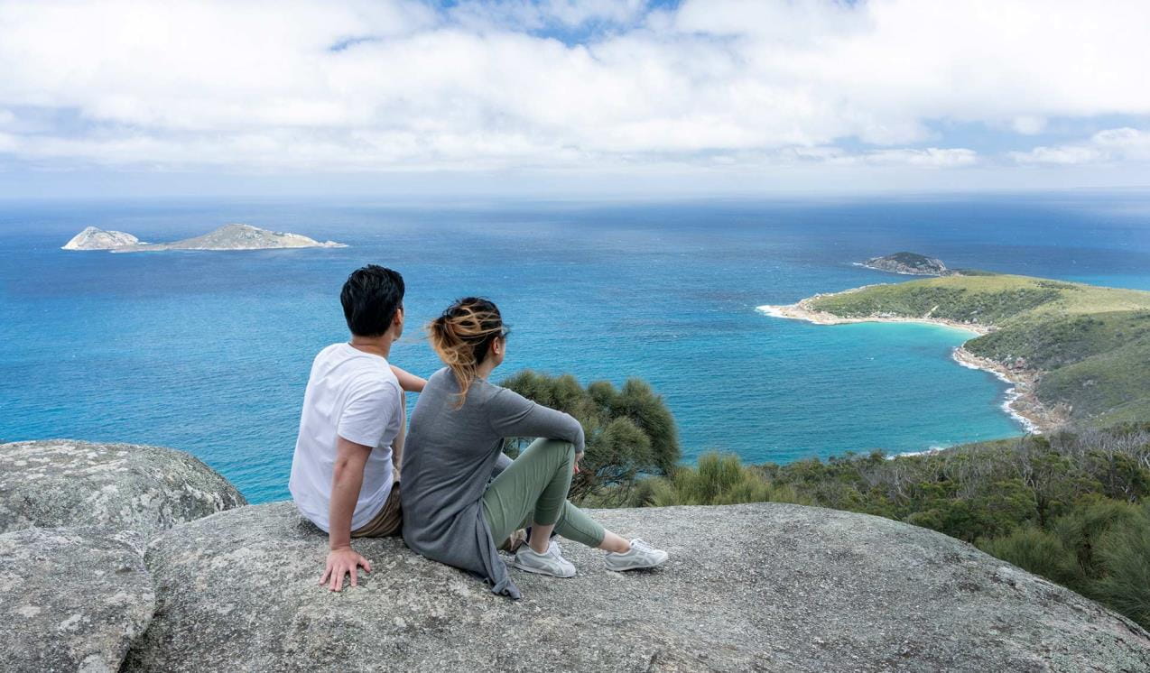
Scale the granite peaks of Mount Oberon for sky-high panoramic views over the sea and a majestic sunset. Mount Bishop is a great alternative. You can walk to the summit from the Lilly Pilly car park or take the side track while on the Lilly Pilly Circuit walk. At the top, you'll see amazing views of the Prom's west coast and offshore islands. For a wider view over the National Park, head for lesser-known Vereker Outlook.
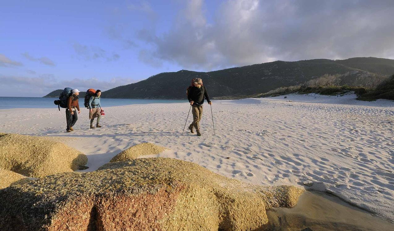
For adventure seekers, enjoy an overnight hike in The Prom. In the north there's a remote and rugged wilderness to explore, while the south is home to the historic Wilsons Promontory Lightstation and Sealers Cove.
Feel the sand between your toes at some of the more secluded beaches of Wilsons Prom, from Cotters Beach to Whisky Bay and Fairy Cove. You can book a free all-terrain wheelchair, TrailRider or beach wheelchair to explore the great outdoors at Wilsons Promontory National Park.
As beaches and coasts are natural environments, you may encounter hazards. Follow our water safety advice to make sure your day out at Wilsons Promontory National Park is a safe and enjoyable one.
Top places
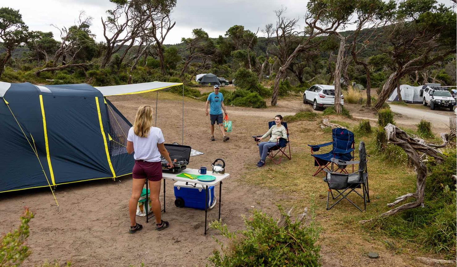
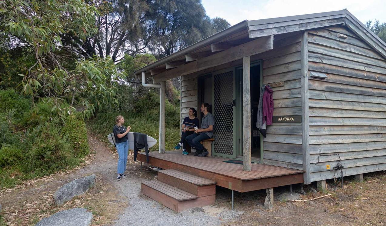
Tidal River Accommodation
Tidal River is the main visitor hub for Wilsons Promontory National Park. This picturesque spot offers a range of accommodations options to make the most of one of Victoria's favourite National Parks.
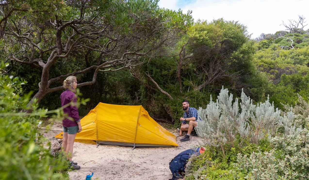
Southern Circuit Overnight Hikes
Venture into the Southern Prom and discover a remote place of great natural beauty. The Southern Prom Circuit overnight hike is a three to five day trail through warm temperate rainforest to the sublime eastern shores of Wilsons Promontory where you can enjoy the white sandy beaches and crystal clear waters of Sealers Cove and Waterloo Bay.
Northern Overnight Hikes
Most of the northern part of Wilsons Promontory is classified as a wilderness zone. In order to preserve the area’s natural values there are few facilities. If you don't want to stay overnight, there are short walks at Vereker Outlook, Prom Wildlife Walk, and Millers Landing.
Darby River to Tongue Point
Offering magnificent views over Darby Swamp, Vereker Range and Darby Beach, The Darby River to Tongue Point Walk climbs an ancient sand dune before following the weathered headland towards Tongue Point.
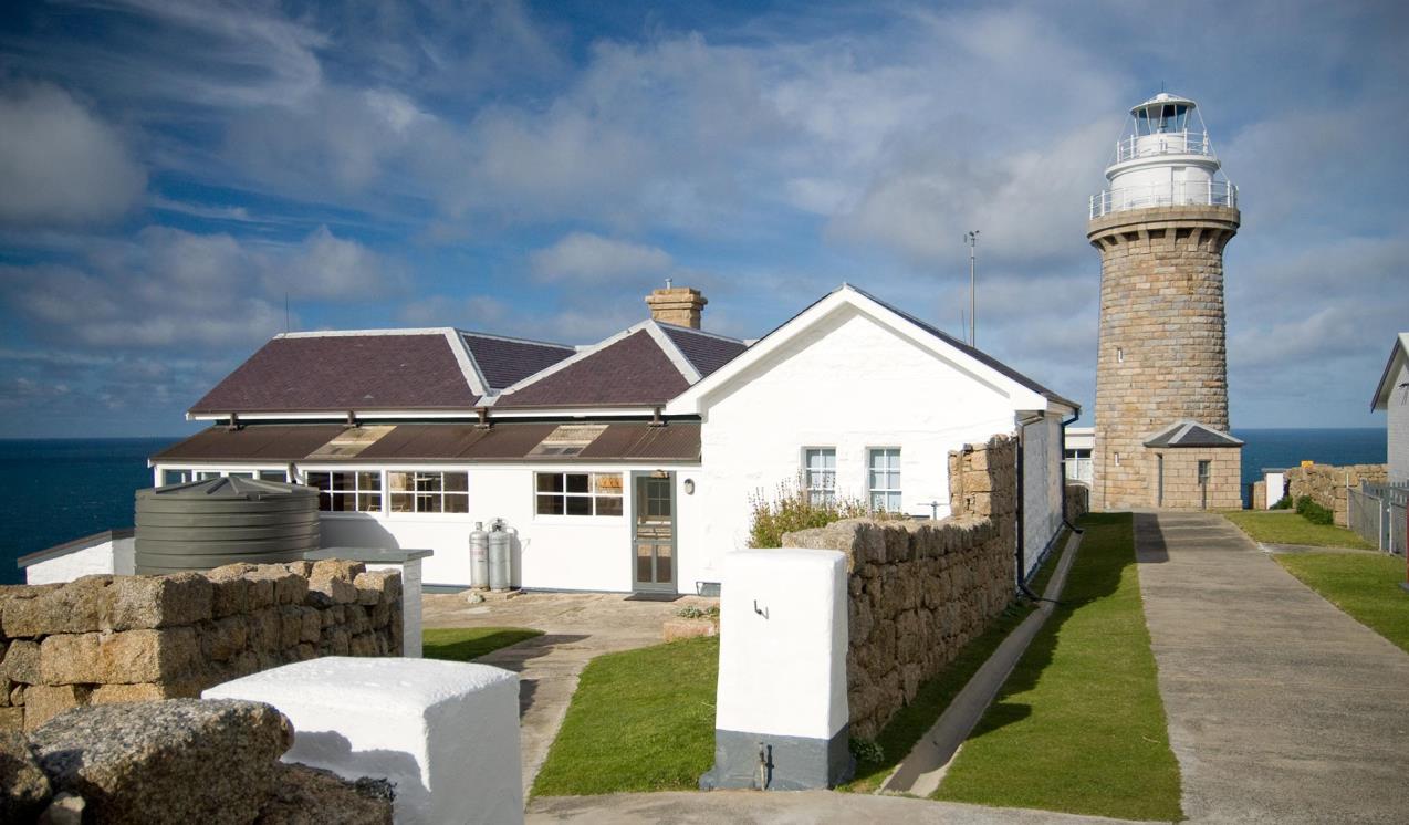
Wilsons Promontory Lightstation
Perched on a small peninsula jutting out into the wild seas of Bass Strait, the Wilsons Promontory Lighthouse and its historic residences are the southernmost settlement on the Australian mainland. Adding to its remote appeal, the lightstation is only accessible by foot, along the Southern Prom Circuit Hikes.
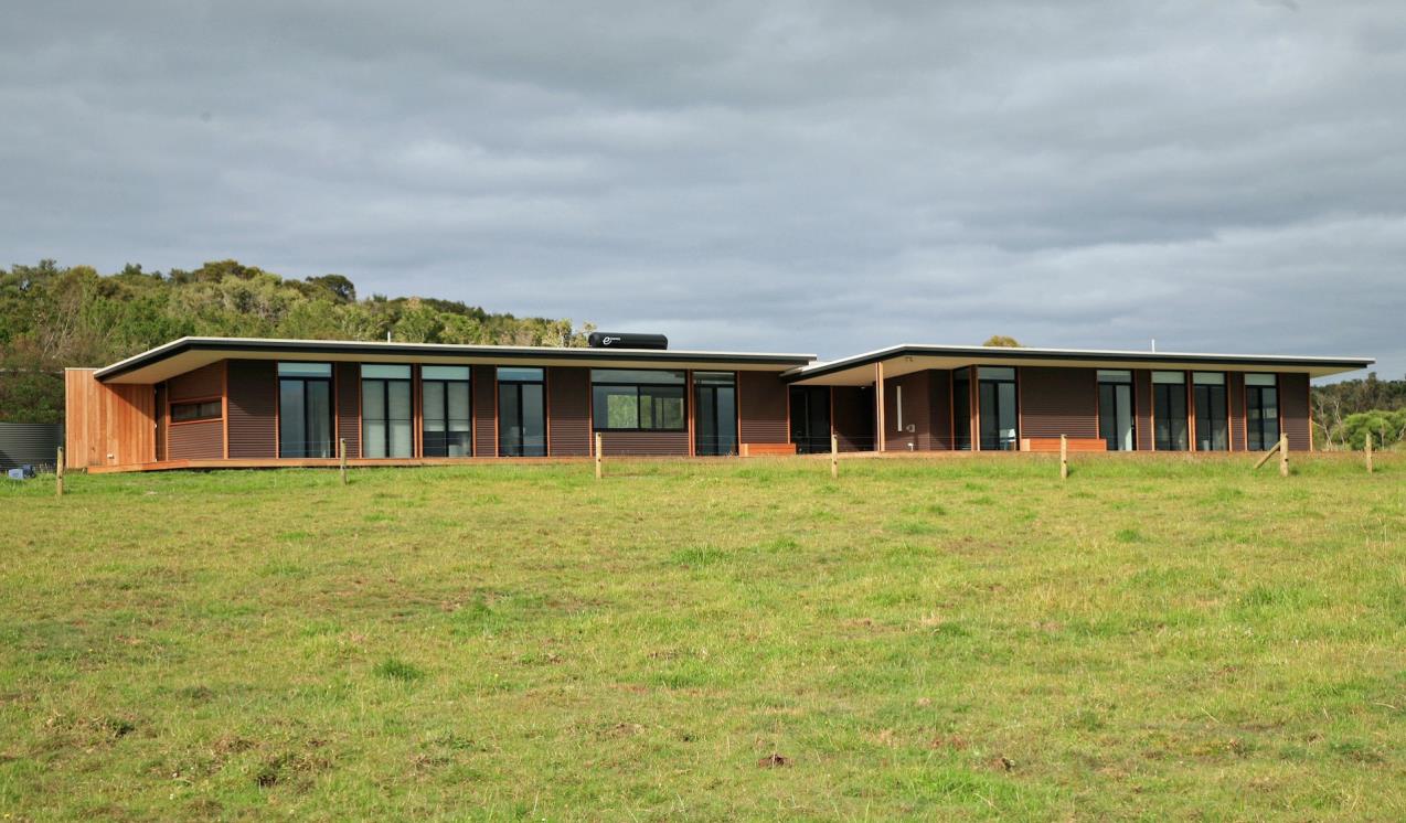
Just Inside The Gate
At the very edge of Wilsons Promontory National Park architectural luxury meets wilderness at Just Inside the Gate. Situated just inside the National Park entrance on 97 acres of the most southerly freehold land on mainland Australia. Come and spend some time relaxing and adventuring on the edge. Just Inside The Gate is a self-catering eco-lodge accommodation for up to eight people.
Tours and adventure experiences in parks
One of the best ways you can get into nature is with a Licensed Tour Operator.
There are more than 400 Licensed Tour Operators across Victoria who are ready and waiting to help you experience and connect with Victoria’s spectacular parks and waterways.
Discover more than 60 different types of nature-based experiences including hiking, mountain biking, boating, four-wheel driving, indigenous culture tours, birdwatching, surfing, diving and so much more.
Licensed Tour Operators know all the best places to go and will plan and prepare your visit to ensure you are safe and can enjoy your nature-based adventure to the fullest.
How to get there
Wilsons Promontory National Park
Tidal River Visitor Centre is 30km south of the park entrance.
There is no fuel at Tidal River. The closest fuel outlet is at Yanakie.
When you're there
Download the Wilsons Promontory National Park visitor guide for more information about the park and the plethora of experiences to be had within its borders.
Help us care for the park:
- No dogs, cats, or other pets allowed
- No fires permitted
- Solid fuel heating compounds for BBQs are not permitted at any time during the year
- No drones or Remotely Piloted Aircraft
- No firearms allowed
- No generators
Need to know
Wilsons Promontory National Park
Preparing for a busy summer
The Prom gets extremely busy over summer. For both visitor safety and your enjoyment, there is a limit to the number of vehicles that can be in the park. On busy summer days it can be challenging to park and safely move around popular sites like Tidal River and Squeaky Beach as cars and pedestrians often share the same roads.
If you are visiting the Prom this summer, please:
- consider visiting the Prom during on a weekday if you can
- carpool to and within the Prom to reduce congestion issues
- you may have to wait in your car, please bring food and water
- arrive before 10am and be prepared for crowds
- check the Prom webpage before you travel for the latest conditions
- only bring a maximum of two vehicles per site with your camping booking – this will be monitored and enforced
- support the park team by leaving the park when you check-out to allow space for new campers and visitors
Accessibility
A range of special equipment is available for the park accommodation at Tidal River to make your stay more comfortable. Park visitors may book this equipment for free by contacting Wilsons Promontory National Park Information Centre on 8427 2122.
A motorised TrailRider and a range of beach wheelchairs are available for park visitors with significant physical disabilities or mobility limitations to explore the great outdoors at Wilsons Promontory National Park.
These all terrain wheelchairs are designed for different abilities and are available for both adults and children. The chairs are suited for sandy and semi-rough tracks where conventional wheelchairs cannot go.
The day visitor area at Norman Beach is accessed by following the Main Road through the Tidal River camping and accommodation area. It consists of a large carpark, picnic tables, covered gas barbecues and a toilet/shower block. There are 12 picnic tables located in open and shaded areas on an undulating lawn surface adjacent to the carpark. All of the tables have an open table end feature for wheelchairs and strollers. Some of these have the roll under end table feature.
Best access to the river and to Norman Beach for all terrain beach wheelchairs and strollers is from 1st Boat Ramp located on the bank of Tidal River at low tide. This is located near the camping area just up from the day visitor area carpark. The beach is approximately 500m from the boat ramp and chair/stroller operators need to be reasonably fit. The boat ramp consists of a concrete surface and has a slope of approximately 1:10 which is reasonably steep. When the water line has receded, there is usually a surface of compacted damp sand at the bottom of the boat ramp. The riverbed at low tide is reasonably level and consists of a damp compacted sand surface and some very shallow water flows in sections. A damp compacted sand surface can be followed all the way to the beach.
It is recommended that access by all terrain beach wheelchairs and strollers is at low tide only. Access along the riverbed and bank is subject to varying water flows in the river. Inspection of the access route to the beach is strongly recommended prior to taking all terrain beach wheelchairs and strollers over it.
Parks Victoria's social script resources for children on the autism spectrum have been developed with the professional assistance of AMAZE to increase the accessibility of its parks for people on the autism spectrum.
Assistance dogs are welcome in Parks Victoria parks and reserves. Entry requirements apply for parks and reserves that are usually dog prohibited, such as national parks.
Education Excursions
This park offers curriculum-aligned ranger-guided excursions for school students. Download the Education Program to find out more and book your visit.
Change of Conditions
Nature being nature, sometimes conditions can change at short notice. It’s a good idea to check this page ahead of your visit for any updates.
-
Notices Affecting Multiple Sites
Stockyard Campground & Toilet Block Closed
Stockyard campground and toilet block are closed until further notice. -
Wilsons Promontory National Park
Sealers Cove boardwalk is closed
The Sealers Cove boardwalk needs to be rebuilt, following major storm and flood damage.This will be a major and complex project. It will replace two kilometres of boardwalk over sensitive terrain while sensitively managing the surrounding environment.There is currently no public access to the boardwalk, and access to Sealers Cove is only possible via a 25km hike from Telegraph Saddle.For more information, including expected timeframes for the rebuild, visit: https://www.parks.vic.gov.au/projects/eastern-victoria/sealers-cove-boardwalk-rebuild.Wilsons Promontory National Park - Invasive Species Control Programs
Introduced species such as deer, rabbits, foxes and feral cats are all major threats to nature. Wilsons Promontory National Park is working towards pest free nature.Targeted invasive species control programs will be in place within Wilsons Promontory National Park between June 2023 - June 2025.Some access restrictions may apply. Please observe local signage.Park Closure - Sunday 4th August, 5pm to Friday 9th August, 8am 2024
Wilsons Promontory National Park will be closed between 5pm Sunday 4th August and 8am Friday 9th August 2024 to undertake park management and conservation programs.
How we keep it special
The Management Plan for Wilsons Promontory National Park directs all aspects of management in the park until the plan is reviewed.
The Wilsons Promontory Conservation Action Plan provides directions for environmental conservation management across the diverse landscape. This covers the grassy woodlands, heathlands, forests, coastal and marine environments.
Wilsons Prom Revitalisation
The Wilsons Prom Revitalisation project will invest in the protection and enhancement of Wilsons Prom. This is critical for delivering superior visitor experiences while reducing the environmental impact of visitation.
Wilsons Prom Sanctuary
Through the Wilsons Prom Sanctuary project, Wilsons Promontory National Park will become a 50,000 hectare safe haven for native plants and animals to thrive. This long-term vision will transform the Prom into Victoria's largest conservation sanctuary. For the latest project updates subscribe to the e-newsletter.