Explore
Alpine National Park
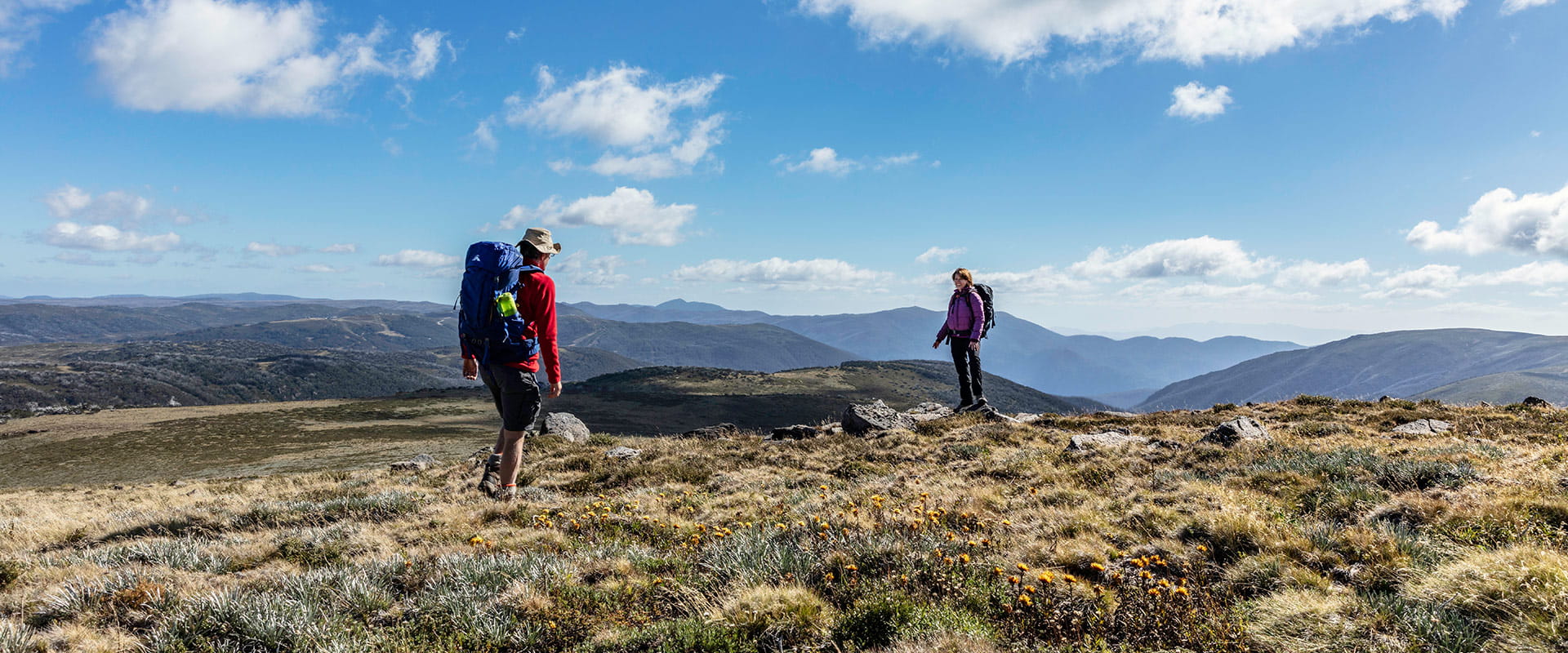
The Alpine National Park is an adventure-lover’s dream. Hike Victoria’s highest mountain ranges, explore wildflower draped landscapes on horseback or head out on world-class mountain bike trails. Run wild rapids on white-water rafting trips, four-wheel drive the secluded reaches of the park or cross-country ski through tangled snow gum forests.
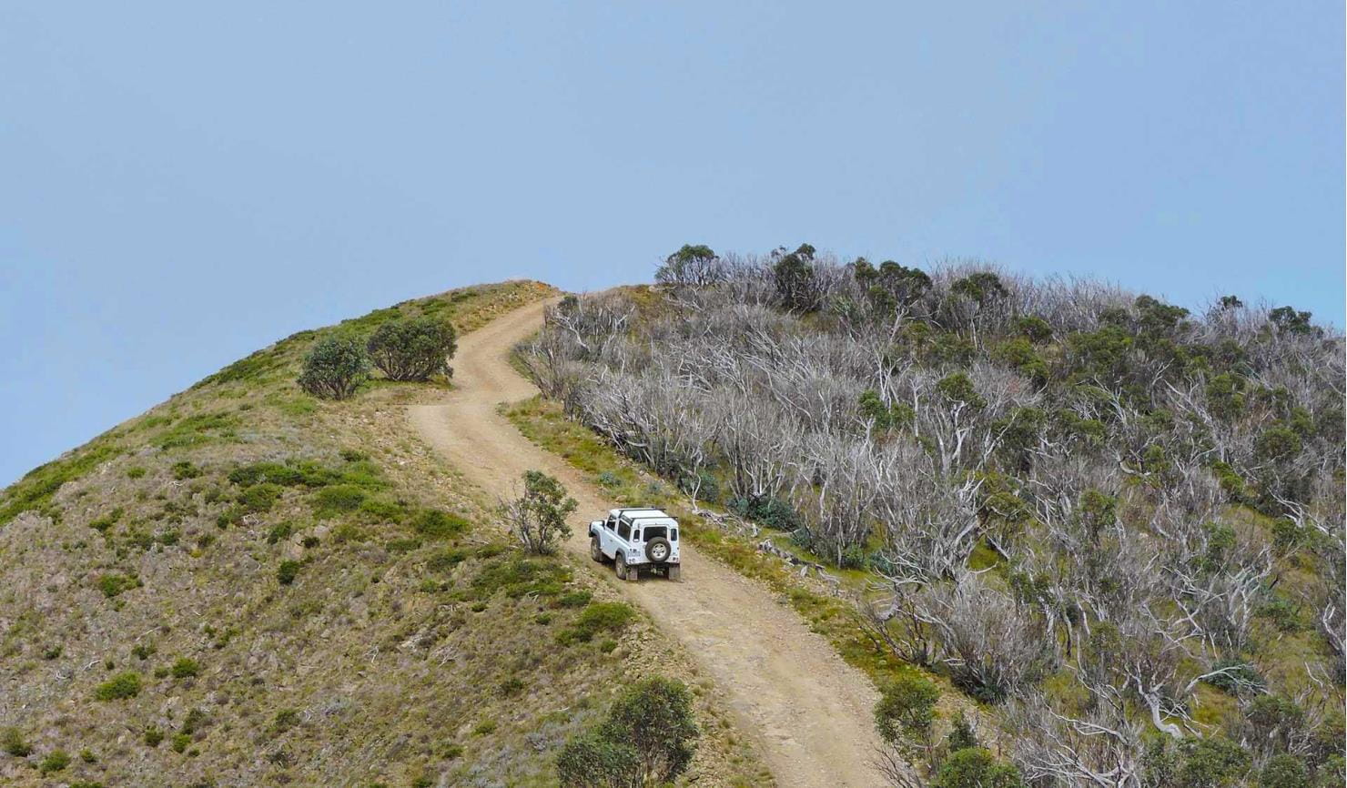
Head out on the Falls to Hotham Alpine Crossing and hike over towering alpine ridgelines, through lush river valleys and unforgettable alpine scenery. Discover the history and heritage of the High Country as you tour through rugged bushland and unforgettable mountain scenery along the Wonnangatta Four-wheel Drive.
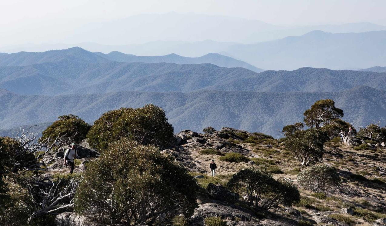
You can follow the sharp spine of The Razorback to Victoria’s second highest peak, Mount Feathertop and take in the stunning panoramas over the Great Dividing Range. Or conquer Victoria’s highest peak, Mt Bogong.
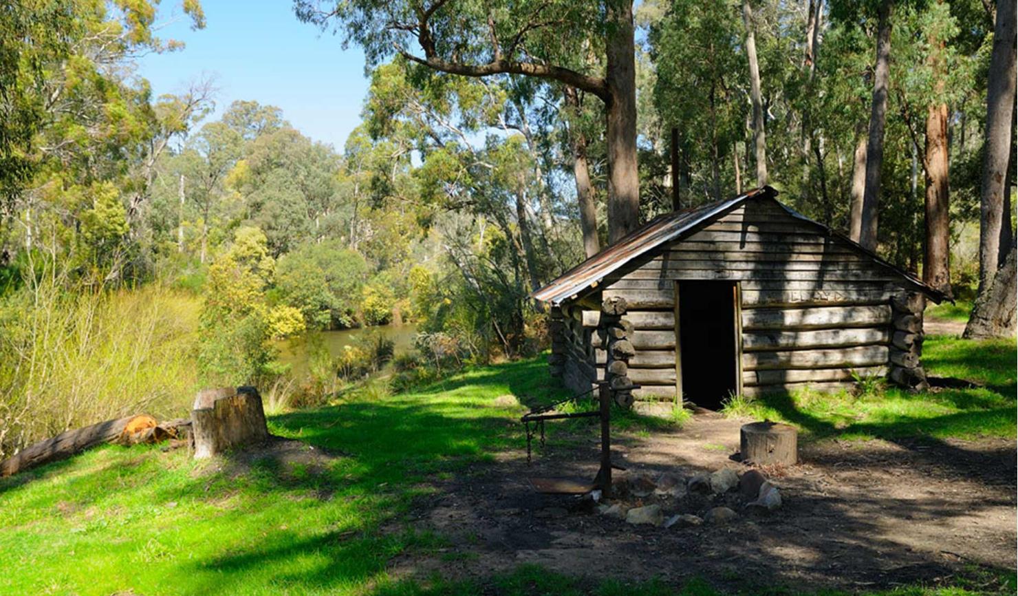
Find historic huts that legendary cattlemen called home scattered throughout the Bogong High Plains or get the adrenaline pumping on a white-water rafting trip down the Mitta Mitta River. The Alpine National Park boasts some of the best ski touring opportunities in Victoria – from well-defined downhill runs to remote cross-country skiing trails and backcountry terrain ready to be carved up.
Mansfield and Whitfield
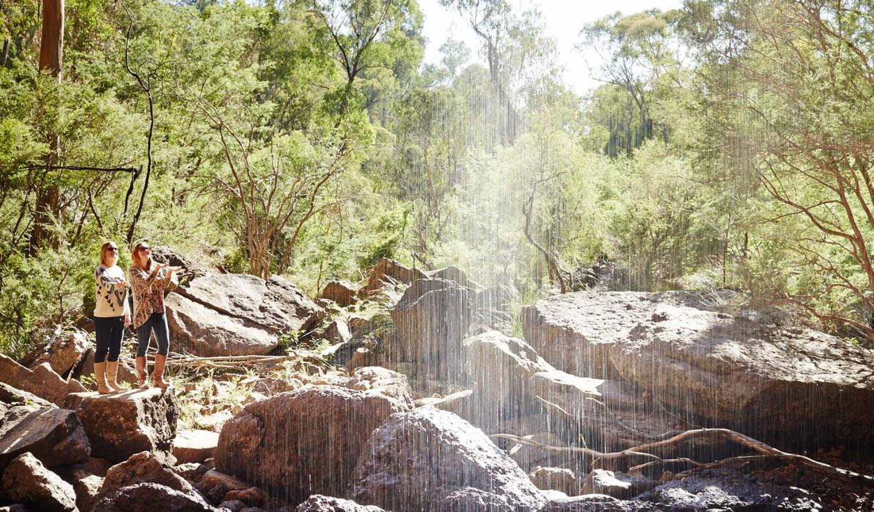
See Victoria’s tallest waterfall, Dandongadale Falls, plunge 255 metres over a sheer cliff face and disappear into the Ross River below. Visit Paradise Falls, where a fine silver mist spills over a red conglomerate ledge or the quaint Little Falls nestled in a narrow fern-laden gully.
Mount Beauty and Bogong High Plains
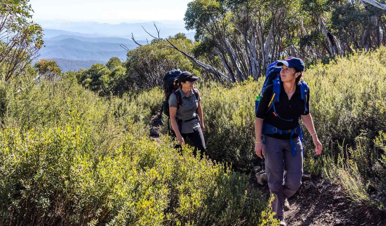
Nestled in the heart of the Alpine National Park, Mount Beauty and the Bogong High Plains offer a plethora of activities for thrill-seekers. Ski the seemingly endless runs and ride the world-class mountain bike trails of Falls Creek, set out on an overnight adventure along the Falls to Hotham Alpine Crossing or tackle Victoria’s highest peak, Mount Bogong.
Omeo and Mitta Mitta
The Mitta Mitta River carves its way through the heart of the Alpine National Park. Its lower reaches stretch from Lake Dartmouth to Anglers Rest where it splits into the Cobungra and Big Rivers. Among ample fishing, camping and four-wheel drive opportunities, the rich gold mining history of Omeo and Mount Wills Historic Area provides plenty of excitement.
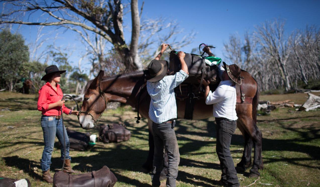
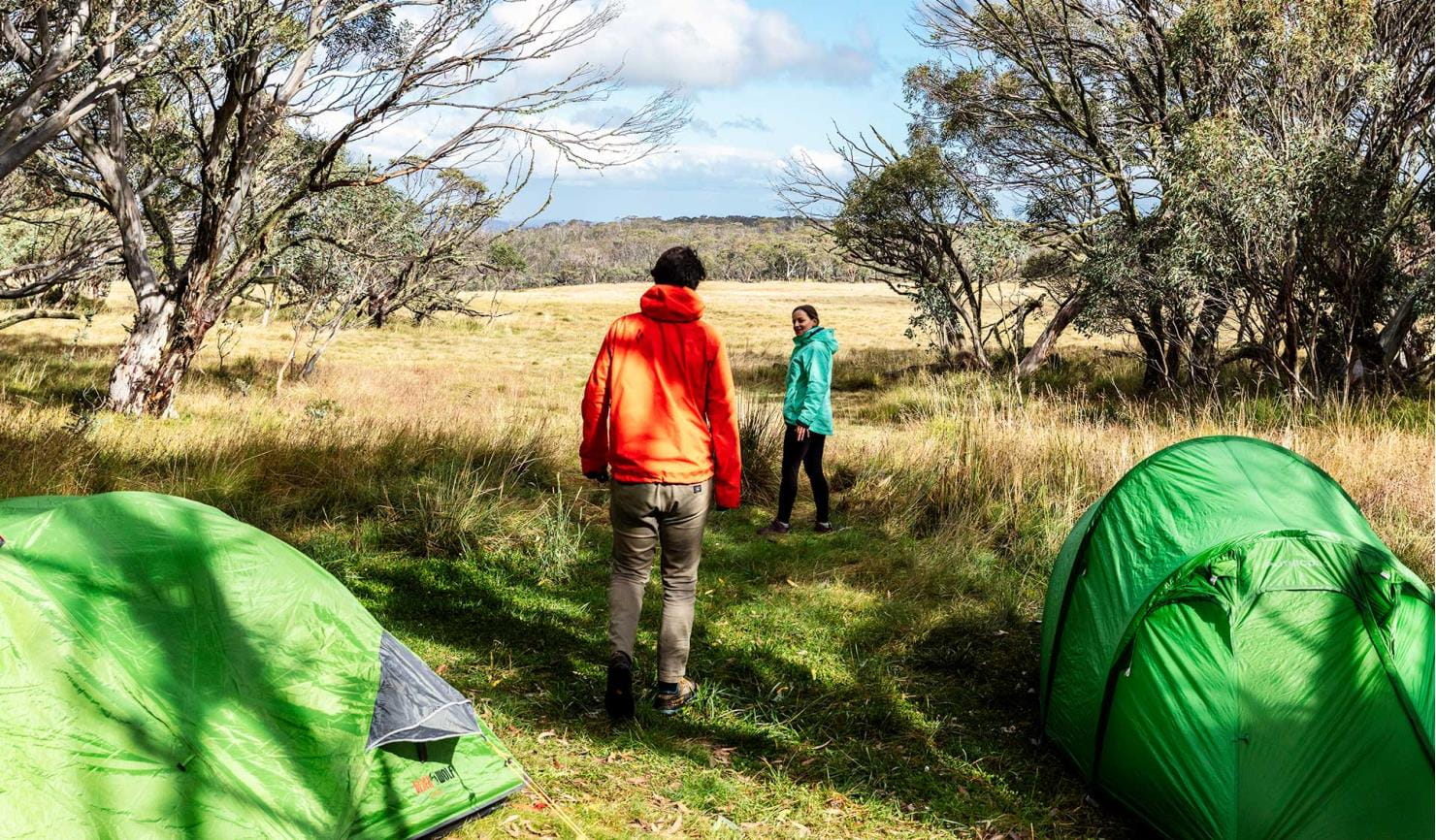
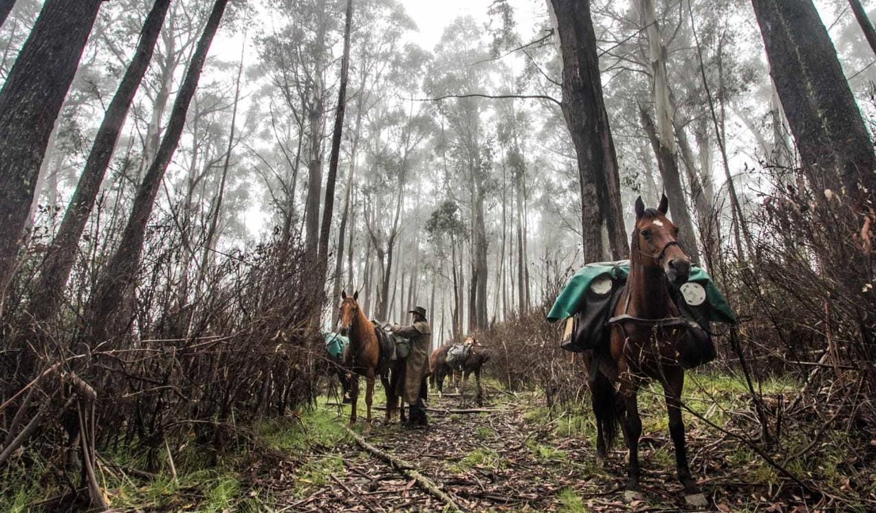
Camping with your horse in the Bogong High Plains
The Alpine National Park and Howqua Hills Historic Area provide a unique and stunning backdrop for multi-day horse rides. Horse riding’s long association with the region started in the 1840s when European explorers and miners used horses in their search for gold and summer pastures.
Camping with your horse in the Howqua Hills
This old gold mining area on the Howqua River is set in a beautiful, secluded valley, once busy with gold miners but now popular for picnics, bushwalking, four-wheel driving, and horse riding. Selected areas in the Howqua Hills Historic Area and some sections of the Alpine National Park have horse yards that can be reserved in advance.
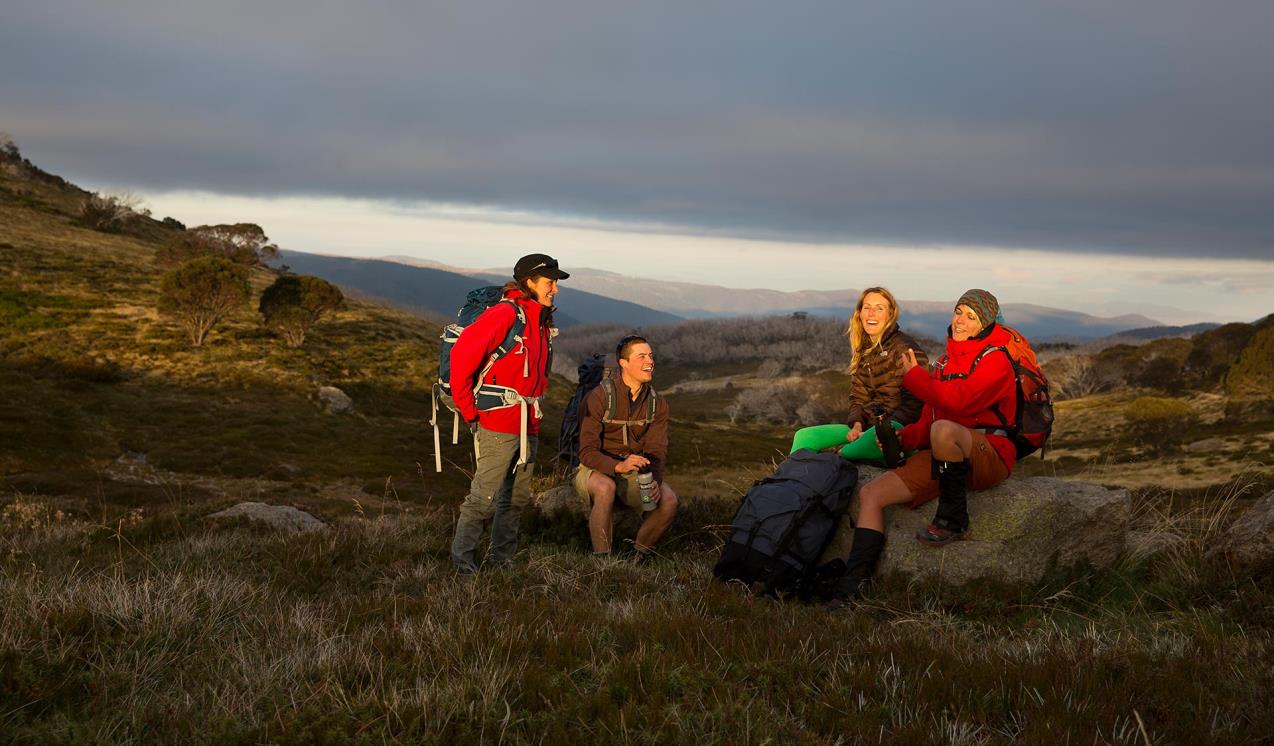
Falls to Hotham Alpine Crossing
The Falls to Hotham Alpine Crossing is a 37km three-day hike through the Alpine National Park from Falls Creek to Mt Hotham. Enjoy spectacular views of mountain ridges from 2000m above sea level, walk through beautiful Snow Gum woodland and camp near two historic huts.
When you're there
The Alpine National Park stretches from central Gippsland all the way to the New South Wales border where it adjoins Kosciuszko National Park. Within the park are some of Australia’s most stunning alpine landscapes, including mountain peaks, escarpments and grassy high plains. See Visitor Guides for further information.
Alpine Discovery Days
Discover historic huts and iconic landscapes with a Volunteer Park Guide for a free, fun and education experience on the Alpine Discovery Days.
Need to know
Alpine National Park
Accessibility
Visiting a park can be more of a challenge for people with disabilities, however in Victoria there are a wide range of facilities to help people of all abilities enjoy our wonderful parks around the state.
Assistance dogs are welcome in Parks Victoria parks and reserves. Entry requirements apply for parks and reserves that are usually dog prohibited, such as national parks.
Alpine back country winter safety
Safe backcountry travel in Victorian Alpine areas during winter requires training and experience. You control your risk by choosing how, when and where you travel, and the activities you participate in.
Subscribe to Parks Victoria
Sign up to receive the latest ideas, inspiration and news delivered right to your inbox.
Change of Conditions
Nature being nature, sometimes conditions can change at short notice. It’s a good idea to check this page ahead of your visit for any updates.
-
Davies Plain Hut & Camping Area (Alpine National Park)
Davies Plain Track - 2.3 km track section currently closed due to flood damage
A 2.3km section of Davies Plain Track, near Davies Plain Hut Camping Area within the Alpine National Park, is currently closed to all vehicles because of significant water damage and severe erosion, following recent flood and storm events in the area. As a result of the temporary closure, Davies Plain Track is not a thoroughfare for vehicles between Tom Groggin and Charlies Creek Camping Area. There is currently no vehicle access to Davies Plain Hut or the adjoining camping area, pending further assessments and subsequent repairs. Nearest camping areas accessible to suitable 4WD vehicles on Davies Plain Track are Charlies Creek Camping Area to the south; and Buckwong Creek Camping Area to the north (near Tom Groggin).Attachments: Flood damaged track section currently closed to all vehicles Davies Plain south (189KB)
-
Alpine National Park
Eastern Alps track closures due to storm and flood damage
The 4x4 tracks in the Eastern Region are an iconic part of Victoria and an important focal point for many people. With a large number of visits per year, they are very popular for outdoor activities such as camping, hiking, mountain biking and four-wheel driving.Unfortunately, sometimes we must close infrastructure in the interests of public safety and environmental protection.
The following tracks have been significantly damaged by storms and floods and are currently closed to motor vehicles to ensure public safety and environmental protection:- Cobberas Track
- Macfarlane Flat Track
- Ingeegoodbee Track
Before visiting, Visitors should always check the Parks Victoria website for the latest information about their destination.Wobonga Track Closure
Wobonga Track is CLOSED due to upgrade works being completed. This closure will be in effect until the 30th of April.- Alternative access to King Basin Track is via Basin Track and Long Spur Track.Planned aerial shooting operations targeting deer - Alpine National Park
Parts of the Alpine National Park will be closed while aerial shooting operations targeting deer are undertaken (See attached map for details).The closures will apply during the following dates:29 April – 2 May 2024 (Bogong High Plains)29 April – 3 May 2024 (Feathertop and Dinner Plain/Dargo High Plains)The following tracks and visitor areas will be open during the operation:OPEN – MT FEATHERTOP AREA· Bungalow Spur· The Razorback· Diamantina Spur· Mt Feathertop· Federation Hut· West Kiewa Logging Road· Blairs HutOPEN – MT HOTHAM/DINNER PLAIN AREA· Great Alpine Road· Dargo High Plains Road· Dinner Plain Track· Blue Rag Range Track· Machinery Spur· Swindlers Spur· Dibbins Hut· Brabralung Trail· Carmichael Falls· Dead Timber Hill Walking Track· Room with a View Walking TrackOPEN – BOGONG HIGH PLAINS AREA· Bogong High Plains Road· Pretty Valley Road· Wallace Hut· Pretty Valley Hut· Pretty Valley Camping Area· Mountain Creek Camping Area· Big River Camping AreaAttachments: Alpine National Park aerial operations information April_May 2024 (9,883KB)
Bogong High Plains Road
Following the landslide at Bogong Village the Bogong High Plains Road is now open however remediation work will continue into the foreseeable future to rectify the damage created by the landslide. Parks Victoria advises that all visitors check the Regional Roads Victoria and Victoria's big build website for the latest traffic updates on closures or delays before visiting.https://regionalroads.vic.gov.au/map/north-eastern-improvements/bogong-high-plains-road-landsliphttps://bigbuild.vic.gov.au/projects/mrpv/bogong-high-plains-road-landslipAmbyne Settlement Road - Very Poor Condition, Limited Access to Alpine National Park east of the Snowy River
Ambyne Settlement Road passes through private property and links Ambyne Road with Ambyne Track, Amboyne Boundary Track and Blackguard Gully Track. This road provides one of the few access routes into and out of the Alpine National Park on the eastern side of the Snowy River.Recent severe storms caused local flash flooding in the Ambyne Valley and have resulted in parts of Ambyne Settlement Road becoming severely damaged with washed out creek crossings in several areas.Visitors need to be advised that access into and out of the Alpine National Park via Ambyne Settlement Road is currently very difficult and should only be attempted by experienced drivers with high clearance 4WDs and recovery equipment.There are no alternate, publicly accessible routes nearby which provide access through the private property in the Ambyne Valley.Attachments: Map - Ambyne Settlement Rd - Very Poor Condition (1,400KB)
Restricted Access at Eastern end of Spring Saddle Track
The eastern end of Spring Saddle Track has restricted access due to machinery continuing to clear soil as part of the Bogong Village landslip remediation works. The track is open to pedestrian traffic but not vehicles and no Park visitors will be able to enter the works site at the Eastern end of Spring Saddle Track. There is signage explaining the restrictions at the Spring Saddle Track Fainter Fire Trail intersections.Storm Damage to Dry River Walking Track
Dry River Walking Track has been impacted by storm events and is in poor condition and difficult to navigate with horses. Alternative tracks should be considered.Mt Pinnibar Track - poor track conditions
Mt Pinnibar Track, between Walkers Road and Tom Groggin Track, has developed sections of significant and deep track erosion following flood and storm events.While the track remains open it is recommended that only experienced drivers in well equipped 4WD vehicles attempt this track in dry conditions.All visitors are advised to consider alternate routes to the summit of Mt Pinnibar until repairs can be carried out.Ground shooting operations targeting Feral Pigs Eastern Alps from 15 April 2024.
Ground operations (ground shooting) targeting Feral Pigs are undertaken across the Eastern Alps, and include areas to the west and north of Suggan Buggan, west of Wulgulmerang, and east of Cobberas and Brumby. The Park will remain open to visitors during operations.
This work is to be carried out dusk to dawn from:
* 15 to 26 April, and
* 29 May to 15 June 2024.Attachments: Flyer for feral pig control FINAL (165KB)
Road Conditions – Tamboritha and Howitt Roads
Tamboritha and Howitt Roads in the Foothills and Southern Alps area of the Alpine National Park are currently recommended for all wheel drive and four wheel drive vehicles with sufficient clearance and appropriate tyres. Road maintenance works have been completed on sections the Tamboritha and Howitt Roads in summer 2024, however some road surfaces conditions remain poor.Vehicles travelling on the these roads require attention to variations of the surface condition.Allow more time for your journey and always drive to the conditions. - Cobberas Track
-
Moroka Hut and Camping Area (Alpine National Park)
Moroka River Pedestrian Bridge CLOSED until further notice
The Moroka River pedestrian bridge is closed until further notice due to being assessed as structurally unsound.Access to Moroka Hut is via the Moroka Range Walking Track (4WD only). -
Notices Affecting Multiple Parks
Ground shooting operations targeting deer
Control operations (ground shooting) targeting deer are undertaken in this area. The Park will remain open to visitors during operations.
Tours and adventure experiences in parks
One of the best ways you can get into nature is with a Licensed Tour Operator.
There are more than 400 Licensed Tour Operators across Victoria who are ready and waiting to help you experience and connect with Victoria’s spectacular parks and waterways.
Discover more than 60 different types of nature-based experiences including hiking, mountain biking, boating, four-wheel driving, indigenous culture tours, birdwatching, surfing, diving and so much more.
Licensed Tour Operators know all the best places to go and will plan and prepare your visit to ensure you are safe and can enjoy your nature-based adventure to the fullest.
How we keep it special
Falls to Hotham Alpine Crossing project planning
The Falls to Hotham Alpine Crossing is a proposed multi-day 57-kilometre walk through the spectacular Alpine region from Falls Creek to Mt Hotham. Stage 1 of the project involves doing track upgrades and creating up to two overnight campgrounds including roofed accommodation options.
Management Plan for Greater Alpine National Park
The Management Plan for Greater Alpine National Park directs all aspects of management of the park until the plan is reviewed.
Protection of the Alpine National Park: Feral Horse Action Plan 2021
The Victorian Government released the Protection of the Alpine National Park: Feral Horse Action Plan 2021 on 1 November 2021, to outline the approach to manage feral horses in the Alpine National Park and adjacent state forests over a ten-year period. The alpine landscape is extremely rare, representing just 0.3% of the Australian land area. Its survival is threatened by the impacts of introduced animals such as deer, pigs and horses.