Explore
Bunyip State Park
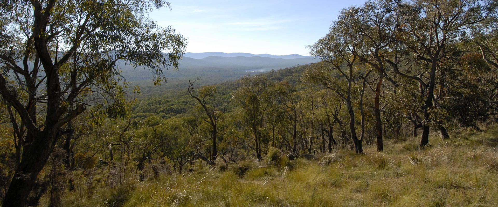
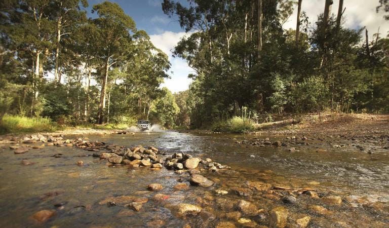
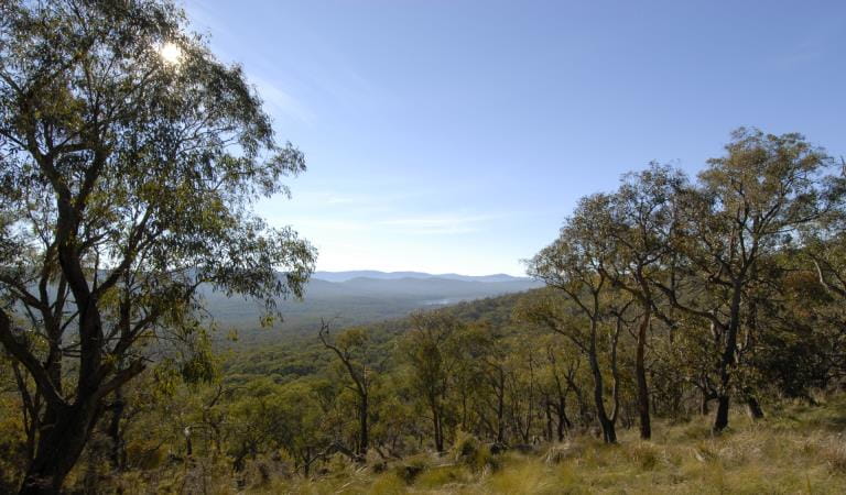
See a green mosaic as you traverse the diverse ecosystems of Bunyip State Park; from heathland swamps to towering mountain ash forests. Explore on foot, horseback, trail bike or in the comfort of your four-wheel drive. Keep an eye out for the southern-emu wren and swamp bush-pea, both rare sights.
Follow the Lawsons Falls Circuit Walk to the only waterfall within Bunyip State Park. The narrow trail meanders through dense bush and verdant fern gullies before emerging at a small clearing with views across to Lawson Falls.
Four-wheel drive and trail bike enthusiasts make your way to the Gentle Annie and Blue Range 4WD and Trail Bike Trails for a thrilling day out. Pitch a tent in the serene setting of Mortimer Camping Area, Nash Creek Campground, Forest Road Campground or the hike-in Freemans Mill Camping Area.
Bunyip State Park is one of the few places in Victoria where our state floral emblem, the Common Heath, and state fauna emblem, the Leadbeater’s Possum, along with our state avian emblem, the Helmeted Honeyeater, can all be found.
Things to do in the area
Four wheel driving and trail bike riding
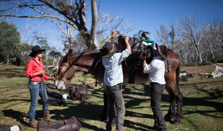
Heritage Horse Trail
Camping at Bunyip State Park
Wildlife and Nature
Tours and adventure experiences in parks
One of the best ways you can get into nature is with a Licensed Tour Operator.
There are more than 400 Licensed Tour Operators across Victoria who are ready and waiting to help you experience and connect with Victoria’s spectacular parks and waterways.
Discover more than 60 different types of nature-based experiences including hiking, mountain biking, boating, four-wheel driving, indigenous culture tours, birdwatching, surfing, diving and so much more.
Licensed Tour Operators know all the best places to go and will plan and prepare your visit to ensure you are safe and can enjoy your nature-based adventure to the fullest.
How to get there
Bunyip State Park
When you're there
When to go
Need to know
Bunyip State Park
Accessibility
Visiting a park can be more of a challenge for people with disabilities, however in Victoria there are a wide range of facilities to help people of all abilities enjoy our wonderful parks around the state.
Assistance dogs are welcome in Parks Victoria parks and reserves. Entry requirements apply for parks and reserves that are usually dog prohibited, such as national parks.
Change of Conditions
Nature being nature, sometimes conditions can change at short notice. It’s a good idea to check this page ahead of your visit for any updates.
-
Mortimer Camping and Picnic Area (Bunyip State Park)
Ferres Walking Track Closure
Ferres Walking Track was severely impacted by storm events during February 2024 and remains closed to walkers until tree risk and cleanup works have been undertaken.Visitors are encouraged to explore other walks in the area such as Nicholls Hut Track to Four Brothers Rocks or walking tracks near Dyers Camping and Picnic Area. -
Notices Affecting Multiple Parks
Areas closed for deer control works
Parks Victoria are continuing deer control in the Bunyip State Park and Kurth Kiln Regional Park. This program will be taking place between the hours of 4pm and 7am on a number of nights between February 19th 2024 and November 30th 2024. These control works are being undertaken by accredited and authorised contractors.For reasons of public safety, various areas of the park will be inaccessible during the evening throughout this period.Signage will be in place at access points when control activities are occurring. For our own safety please observe the signage during this time and do not enter any closed areas.For further information please call 131963Attachments: BSP_KKRP map for brief (642KB)
Areas of Bunyip State Park and Kurth Kiln Regional Park closed for deer shooting operations
Areas of Bunyip State Park and Kurth Kiln Regional Park will be closed from dusk (4:00pm), until dawn (7.00am) on the following nights April 29th and 30th, May 1st, 2nd, 20th, 21st, 22nd and the 23rd .These closures are for ground shooting operations controlling introduced deer species. Signs will be displayed at all official entrance points to the control zones during the control operation.During the hours of 7:00 to 18:00 on the 11th, 12th and 13th of June areas of Bunyip State park will be closed to the public. These closures are for aerial shooting operations controlling introduced deer species. Signs will be displayed at all official entrance points to the control zones during the control operation.All camping grounds/visitor areas will be closed when the control activities are underway.Areas closed include:Nash Creek Camping GroundFreemans Mill Camping AreaDyers Camping and Picnic GroundMortimer Camping and Picnic AreaLawson Falls Picnic GroundForest Road Unloading AreaCannibal Creek Horse Unloading AreaHelmet Track Unloading AreaParks Victoria is responsible for conservation management to restore and protect park habitat, including the control of introduced plant and animal species.This program will:• Reduce habitat structure damage and minimise browsing impacts on habitat regeneration• Focus on movement corridors that aim to reduce the impact of deer grazing on surrounding private landFor your own safety please observe the signage during this time and do not enter any closed areas.For further information please call 131963Attachments: BSP_KKRP map for brief (642KB)
-
Bunyip State Park
Bunyip State Park - Closure of Mortimer Nature Walk
Mortimer Nature Walk was severely impacted by storm events during February 2024 and remains closed to walkers until tree risk and cleanup works have been undertaken.Visitors are encouraged to explore other walks in the area such as Nicholls Hut Track to Four Brothers Rocks or walking tracks near Dyers Camping and Picnic Area.Attachments: Mortimer Nature Walk Closure March 2024 (908KB)
Nash Creek Campground Upgrades
Nash Creek Campground will be closed until September 2024 while upgrades to the camping facilities are undertaken.Parks Victoria will be increasing the number of camping sites to accommodate motorhomes and caravans, improving vehicle parking and entry road, treating hazardous trees to make the campground safer for visitors and will be formalising existing sites to protect environmental values. Other facilities such as picnic tables and firepits will also be installed.Visitors are encouraged to use other campgrounds within Bunyip State Park (such as Mortimer Camping and Picnic Area, Dyers Camping and Picnic Ground and Forest Road Camping Area) and Scout Loop Camping Area in nearby Kurth Kiln Regional Park.For further information please contact the Parks Victoria Information Centre at info@parks.vic.gov.au or call 13 1963.
How we keep it special
We aim to ensure that our valued parks, and the natural assets and cultural heritage they hold, can be enjoyed now and by future generations.
Bunyip State Park
- Mon - Fri:
- 24 hours
- Sat - Sun:
- 24 hours