Explore
Croajingolong National Park
Croajingolong National Park follows the remote coast of far-east Victoria and is home to ancient forests, pristine inlets, giant sand dunes and abundant wildlife. Canoe, kayak or boat to explore Tamboon, Mallacoota and Wingan Inlet. Camp at Thurra River, walk the Wilderness Coast or step back in time at Point Hicks Lightstation.
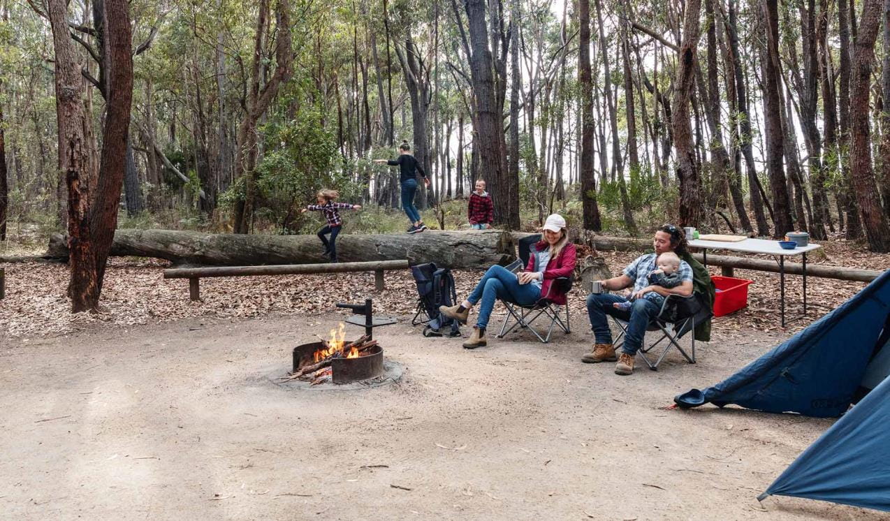
Croajingolong is all about wilderness and escaping civilisation. Basic but picturesque campgrounds can be found scattered along the many inlets of the coast along this part of Victoria. These sheltered water bodies are also perfect for fishing. Get back to nature and camp at the remote and peaceful Wingan Inlet, Shipwreck Creek, Mueller Inlet or Peachtree Creek Campgrounds. Spot Brush-tailed Possums, Long-nosed Bandicoots and Lace Monitors. At night, listen out for the cackling sound of the Yellow-Bellied Glider.
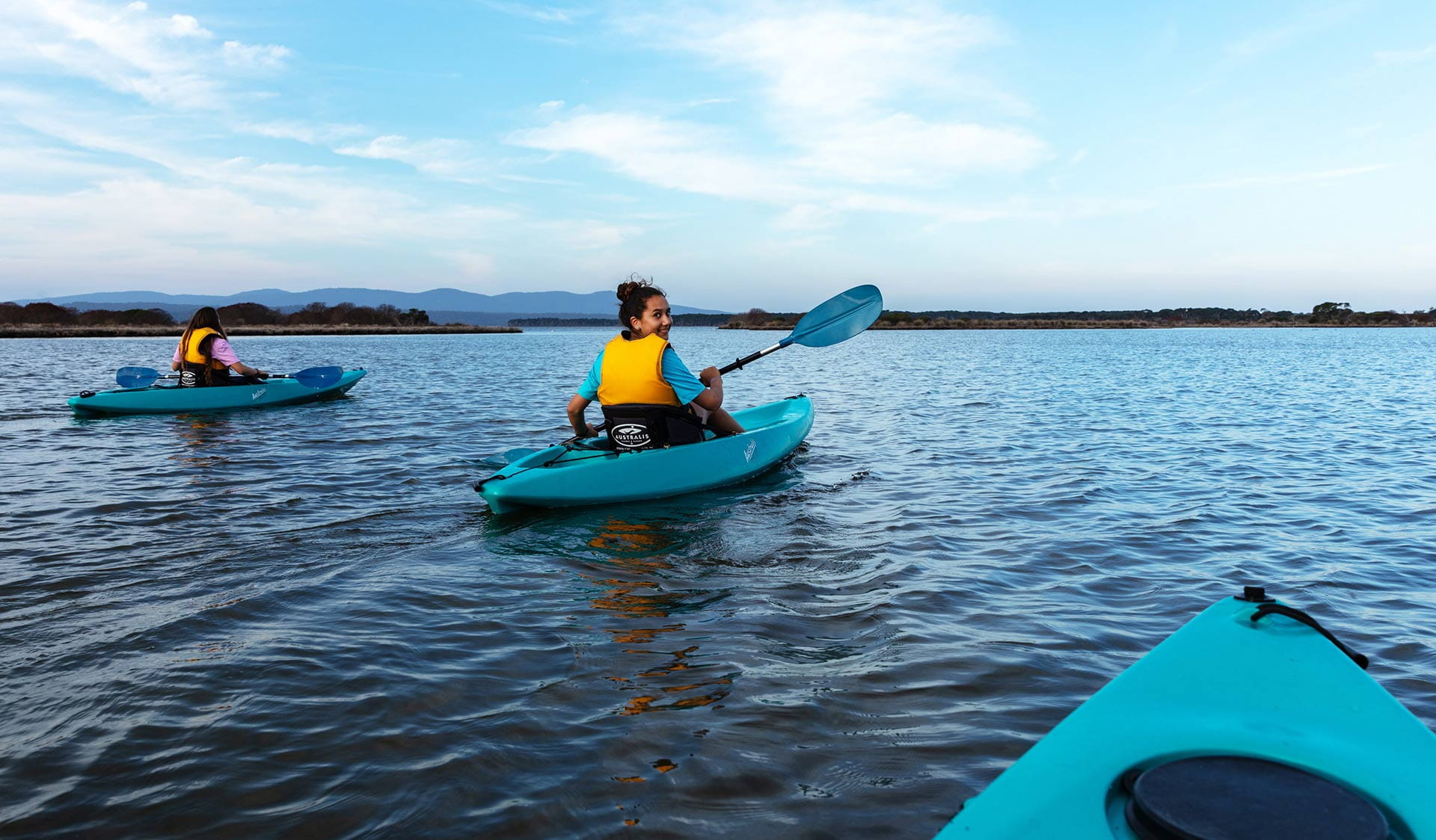
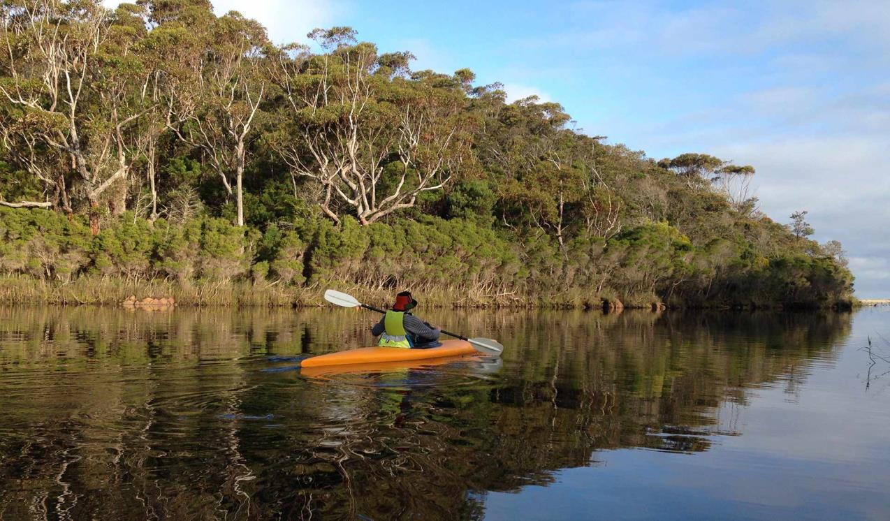
Make the most of the other pristine waterways of Croajingolong. Go canoeing and kayaking at Tamboon, Mueller, Wingan or Mallacoota Inlet. Bemm River and Mallacoota Inlet are amazing places to go fishing. Catch bream, perch, tailor, mullet and flathead, among other species.
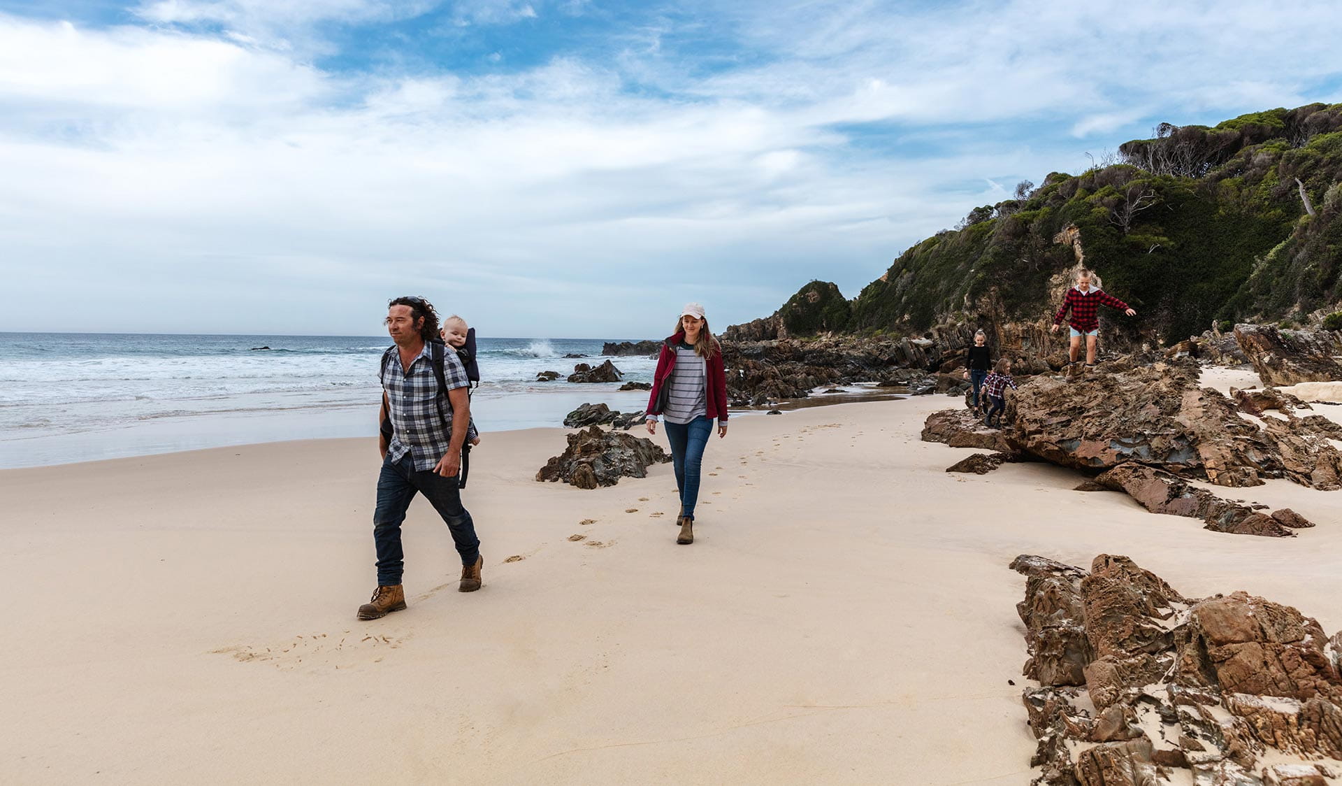
Explore the diverse nature of Croajingolong and set out on one of the shorter walks within the park - from Mount Everard to the Wingan Rapids and Lake Elusive, The Narrows and Heathland Walks. Follow the Fly Cove Walk from Wingan Inlet Campground to see fur seals basking on rocky islets.
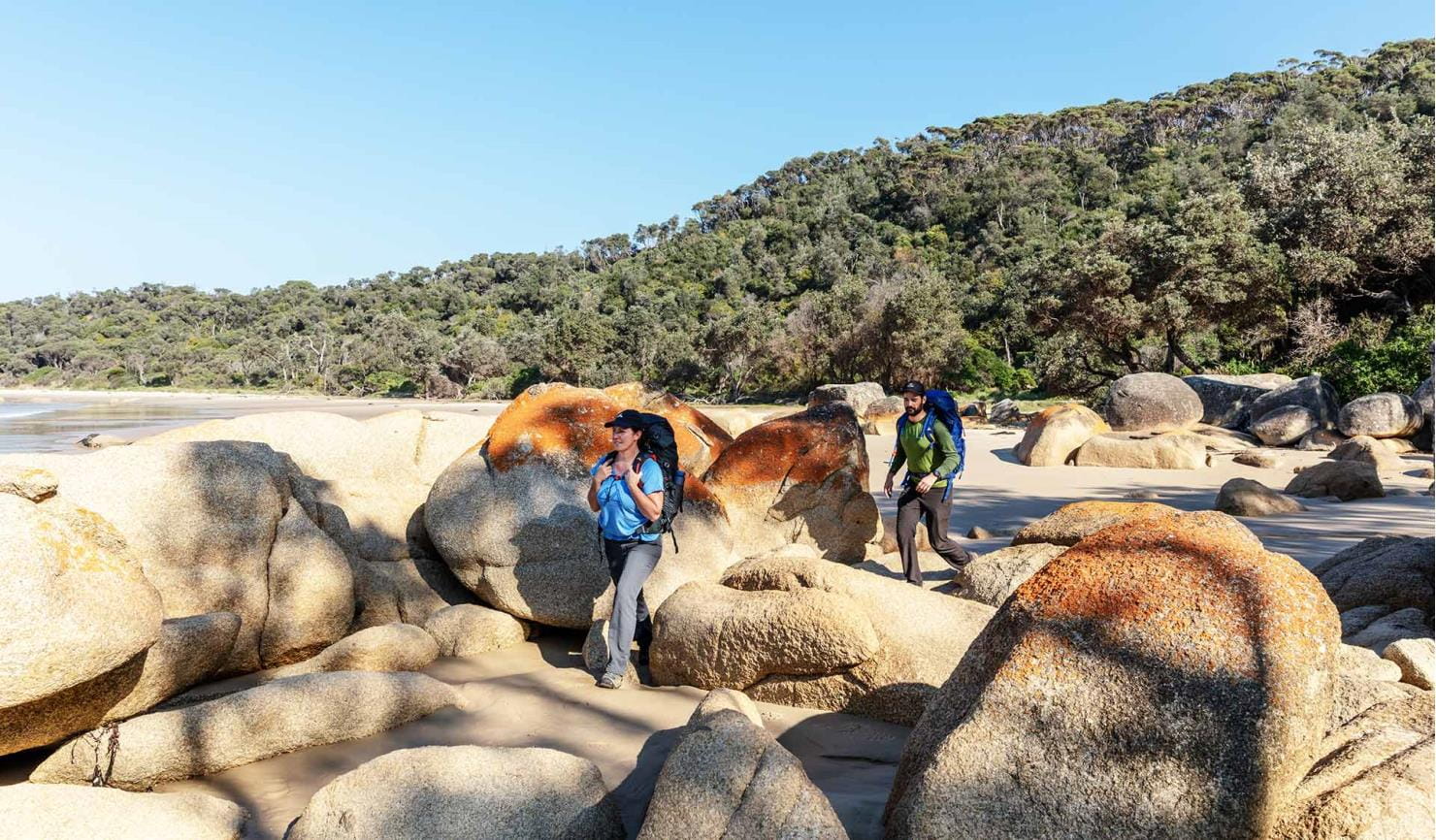
Experienced hikers might fancy the ultimate challenge of the Wilderness Coast Walk. Far from civilisation, this multi-day hike takes in isolated stretches of coastline, pristine river estuaries and untouched landscapes.
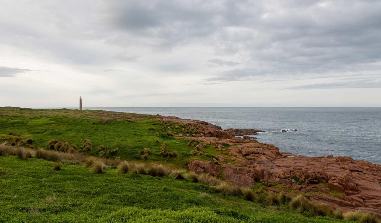
Near Thurra River, you can see the historic lighthouse of Point Hicks. Take in ocean views and see whales on their annual migration from October to May. People looking for a little more comfort can also stay at the old lighthouse keeper’s residence.
The birdwatching here is phenomenal. Of particular interest are birds such as the Glossy Black Cockatoo, Scarlet Honeyeater and Topknot Pigeon, which are more commonly associated with New South Wales or Queensland. Keep your eyes out for the majestic White-bellied Sea Eagle and your ears open for the mimicking calls of the Superb Lyrebird.
As beaches and coasts are natural environments, you may encounter hazards. Follow our water safety advice to make sure your day out at Croajingolong National Park is a safe and enjoyable one.
Top places in the area
Shipwreck Creek Campground
Shipwreck Creek Campground offers a secluded camping experience among tall eucalypt trees. A great escape from nearby Mallacoota, this small cosy campground is a short walk away from the secluded Shipwreck Beach named after the wreck of The Schah (1837), one of Victoria's oldest shipwrecks.
Mueller Inlet Campground
Base yourself at Mueller Inlet Camp on your Croajingolong adventure. Camp under starry skies at night and lose yourself in birdsong and wilderness by day. Explore the expansive inlet by kayak or canoe. Or check out nearby Thurra River Dunes and historic Point Hicks Lighthouse.
Peachtree Creek Campground
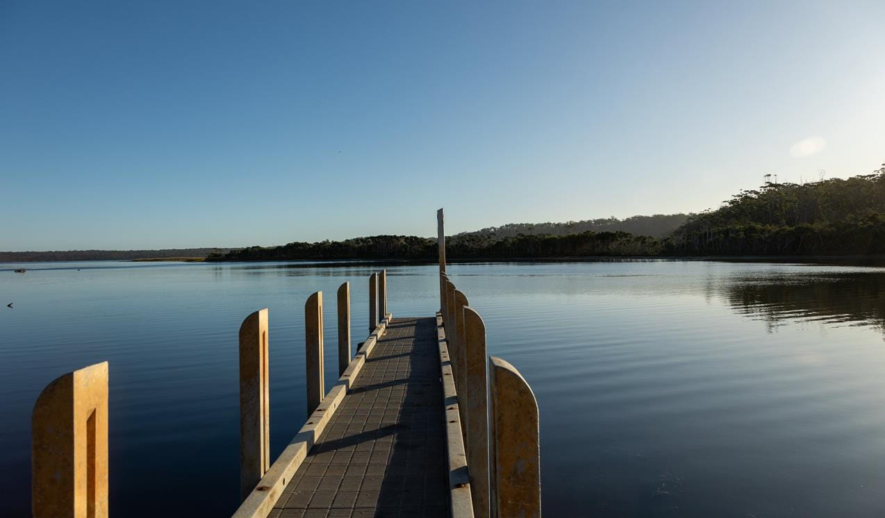
On the eastern shore of Tamboon Inlet, Peachtree creek is the perfect spot to cast a line of the jetty or simply relax by the waters’ edge. There is neither vehicle nor walking access to the coast, so boats are an excellent way to explore the area.
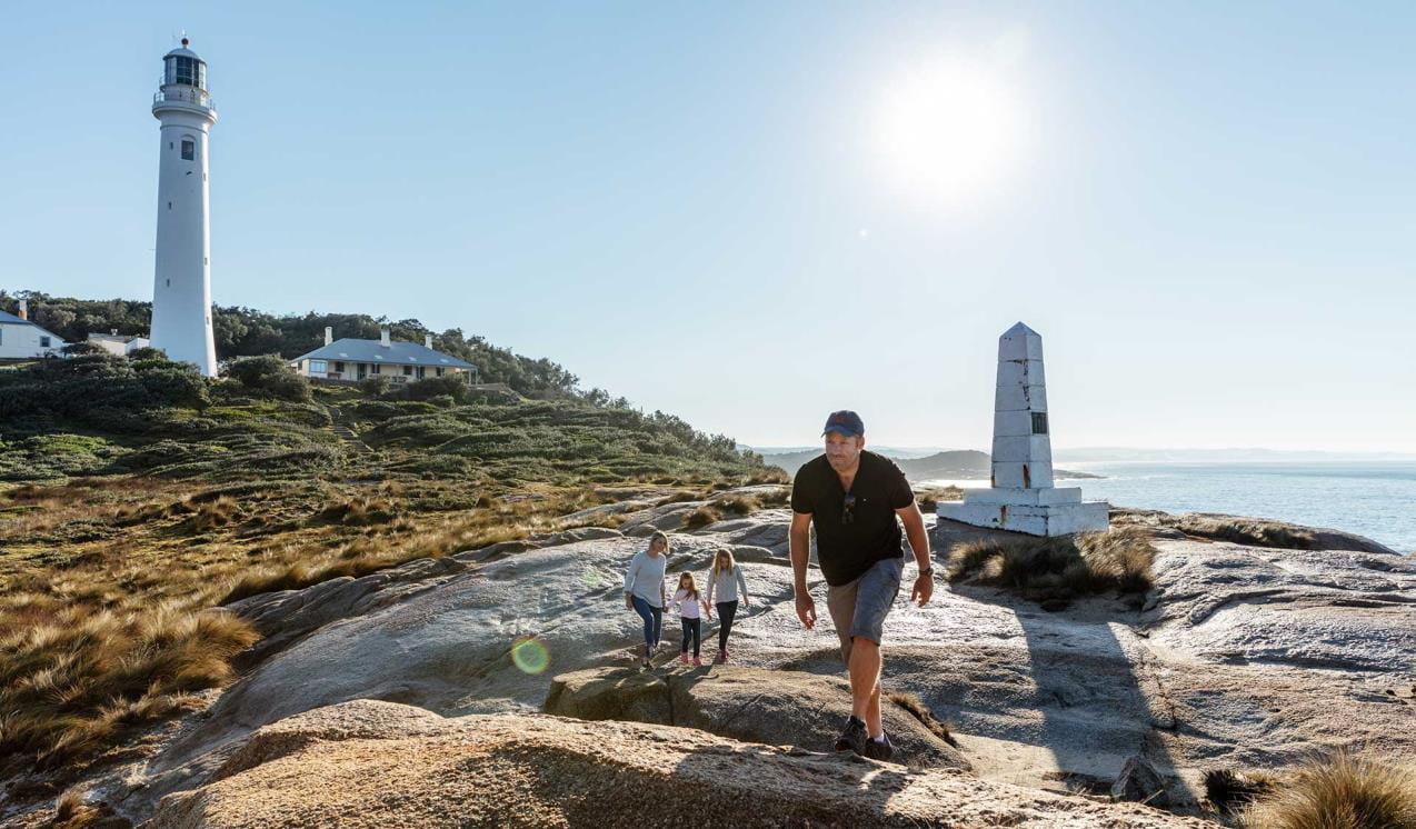
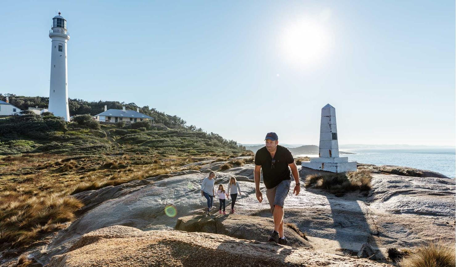
Point Hicks Lighthouse
The secluded and pristine Croajingolong National Park is home to the historic Point Hicks Lightstation, claimed to be Captain James Cook’s first sighting of mainland Australia. Steeped in rich Aboriginal and European history, explore the reserve on foot, join a tour of the lighthouse or stay a night in the lighthouse keeper’s cottage.
Thurra River Campground
Perfectly positioned to explore nearby Point Hicks and the Thurra River Dunes, the large Thurra River Campground sits in the surrounds of stately eucalypt trees. Explore the seemingly endless stretch of pristine coastline, walk to the nearby dunes and discover the rich history of Point Hicks Lightstation.
Wingan Inlet Campground
Nestled on the western shores of Wingan Inlet, among tall Bloodwood trees, Wingan Inlet Campground offers a peaceful camping experience in one of the most secluded corners of Victoria. Jump in a canoe or kayak, or follow Fly Cove Walk to access the pristine sandy beaches of Croajingolong National Park.
Gabo Island Lighthouse Reserve
Just off the pristine coast of Croajingolong National Park, you'll discover Gabo Island. Wild and remote, this island is surrounded by magnificent views and offers a unique day trip or stay.
When you're there
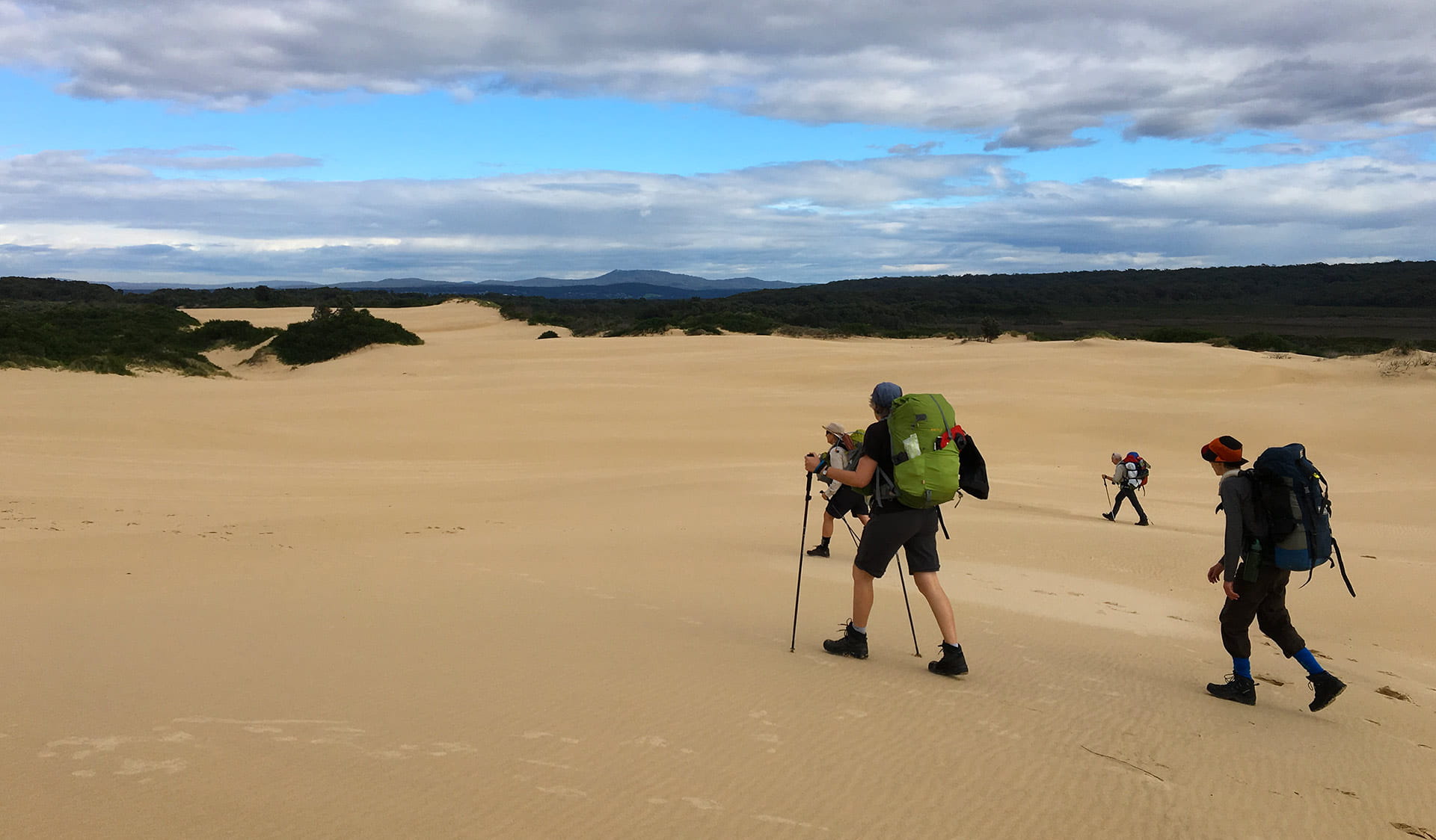
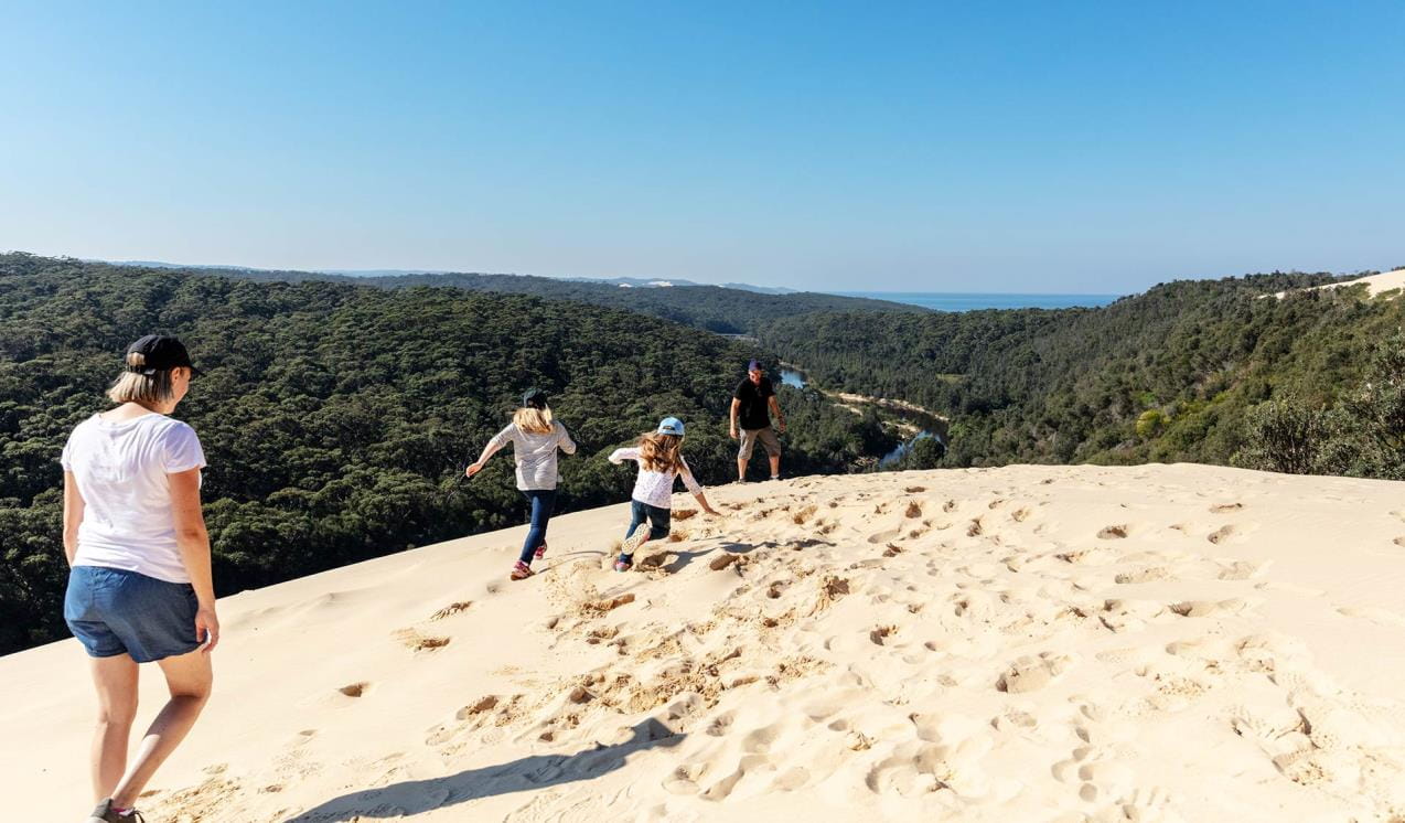
Croajingolong offers a selection of great day trips. If you're camping at Thurra River, explore the unique landscape of the Thurra River Dunes, towering 30 metres over the coast below. These are the biggest sand dunes in Victoria.
Download the Visitor Guide for more information.
Need to know
Croajingolong National Park
Accessibility
The camping area and picnic facilities at Shipwreck Creek are reasonably accessible. They are located on flat ground and free of obstacles. The path out to the centrally located toilets is clear and accessible, however the toilet block itself lacks accessible features.
Assistance dogs are welcome in Parks Victoria parks and reserves. Entry requirements apply for parks and reserves that are usually dog prohibited, such as national parks.
Change of Conditions
Nature being nature, sometimes conditions can change at short notice. It’s a good idea to check this page ahead of your visit for any updates.
-
Mueller Camp (Croajingolong National Park)
Mueller Inlet Campground Flooded
The mouth of Mueller River is currently closed, recent rains in the catchment have caused flooding at Mueller Campground. Campsites 4 - 8 at Mueller Inlet campground are now flooded. Campsites 1 - 3 and the carpark are currently unaffected. -
Croajingolong National Park
Closure of the Goanna bay Jetty
Parks Victoria has recently closed the Goanna Bay Jetty (Mallacoota Inlet) for public safety reasons.The closure follows condition monitoring of the jetty that raised some concerns about its safety and structural integrity. A subsequent engineering assessment confirmed that the jetty’s condition was no longer safe for visitors.The jetty was closed on Friday 10th November and will remain so until further notice.Please note that the Goanna Bay day visitor area remains open to the public. However visitors will not be permitted to use the jetty during the closure period and will have to rely on alternative methods of safe access such as beaching or anchoring vessels to the shoreline.Croajingolong National Park information update 12 February 2024
Point Hicks Road is closed south of Bald Hills.The following six areas are closed because of the 2019/2020 bushfires and coastal erosion caused by ongoing heavy rainfall. Visitors are unable to access the Point Hicks Lighthouse, Thurra River Campground, and nearby walking tracks. Parks Victoria continue to maintain surveillance and security of these areas. Please continue to monitor this site for updates and change of conditions.· Point Hicks Lightstation· Thurra River Bridge· Thurra River Campground· Dunes Track· Saros Track· Sledge TrackThe Wilderness Coast Walk is open all the way from Bemm River to Mallacoota. Staff have recently marked sections of the track however, combined flood and fire damage have made some areas more difficult to negotiate. Hikers must be able to self-navigate with a map and compass.The following walking track is closed:· Wingan Inlet Rapids WalkThe following jetty around Mallacoota is closed:· Kingfish PointSeasonal road closures generally operate from after the long weekend in June through to the end of October, but many remain closed in areas affected by significant rainfall and flooding across Victoria in late 2022. The following tracks remain closed:· Betka Track· Miners Track· Lakeview Track· Howe Flat Track· Howe Hill Track· Barracoota TrackThe water trough at Wingan Inlet Campground is now reconnected to the creek. Visitors are reminded that this is not a potable source and must be treated before drinking.Ongoing heavy rainfall has impacted areas of Croajingolong National Park and other areas of the state. Monitor this page for updated information and site closuresAerial shooting operations targeting deer
Partial park closures will be in place during these dates while aerial shooting operations targeting deer are undertaken.18-22 March 202425-27 March 202416-20 September 20249-13 December 2024See attached map for details.Attachments: Croajingolong NP aerial operations information (523KB)
Aerial shooting operations targeting deer – Cape Howe
Partial park closures will be in place during these dates while aerial shooting operations targeting deer are undertaken.18-22 March 202425-27 March 202416-20 September 20249-13 December 2024See attached map for details.Attachments: Cape Howe aerial operations information (632KB)
-
Notices Affecting Multiple Parks
Ground shooting operations targeting deer
Control operations (ground shooting) targeting deer are undertaken in this area. The Park will remain open to visitors during operations.
Tours and adventure experiences in parks
One of the best ways you can get into nature is with a Licensed Tour Operator.
There are more than 400 Licensed Tour Operators across Victoria who are ready and waiting to help you experience and connect with Victoria’s spectacular parks and waterways.
Discover more than 60 different types of nature-based experiences including hiking, mountain biking, boating, four-wheel driving, indigenous culture tours, birdwatching, surfing, diving and so much more.
Licensed Tour Operators know all the best places to go and will plan and prepare your visit to ensure you are safe and can enjoy your nature-based adventure to the fullest.
How we keep it special
The Croajingolong National Park management plan articulates the vision, goals, outcomes, measures and long-term strategies for the park within planning areas.
The East Gippsland Conservation Action Plan provides directions for environmental conservation management across the diverse landscape, including Croajingolong National Park. This covers the varied ecosystems across the area which range from heathlands to forests, woodlands, wetlands and other marine environments.
Croajingolong National Park bushfire recovery
We are reconstructing damaged campgrounds and visitor facilities throughout Croajingolong National Park and around Mallacoota following major bushfire damage in summer 2019/20.