Explore
Dandenong Ranges National Park
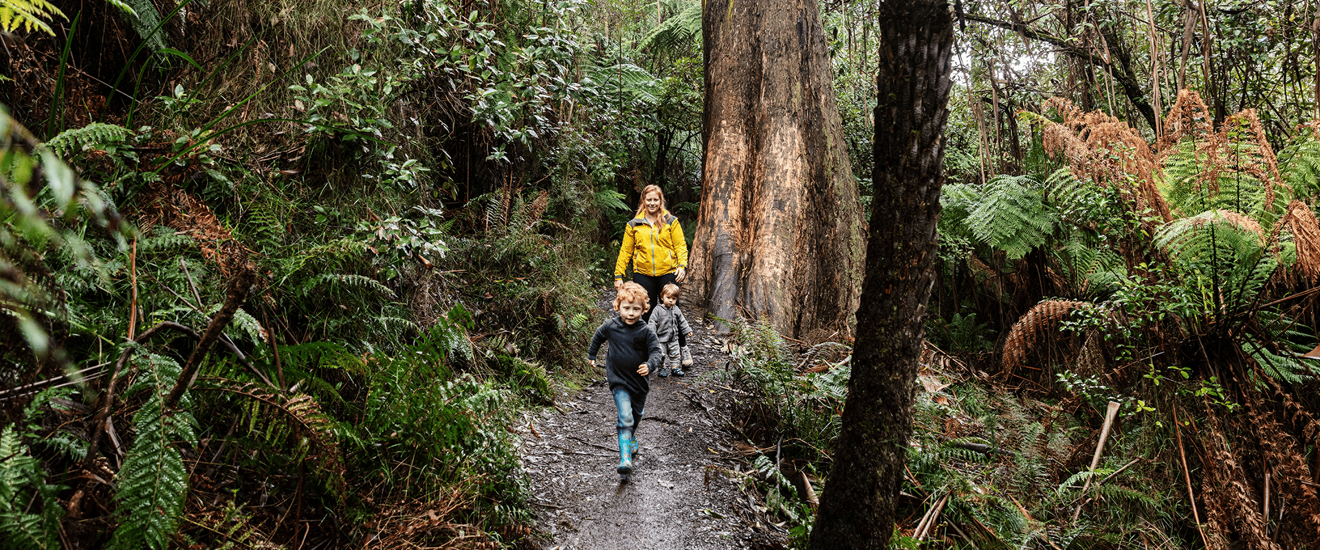
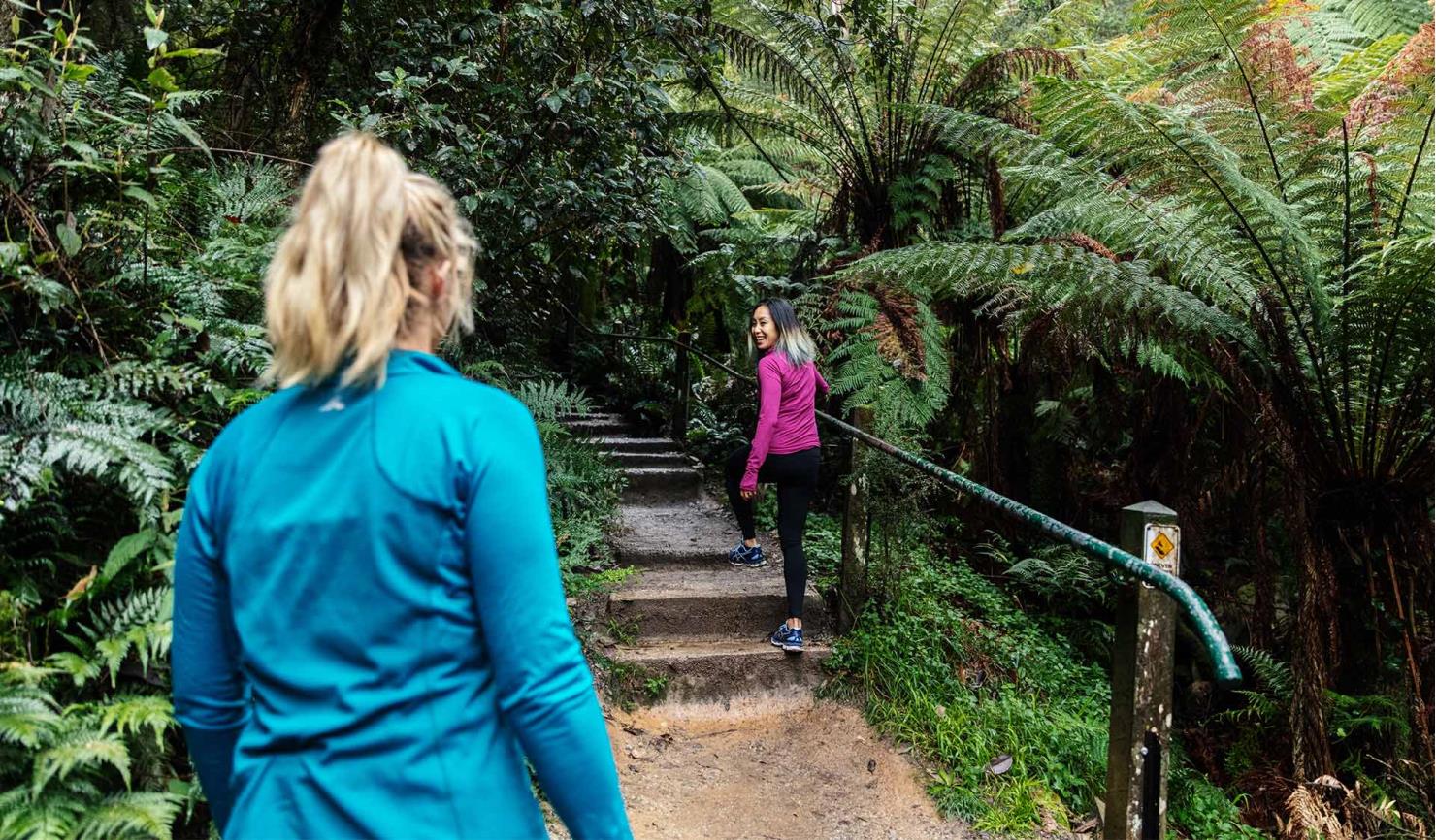
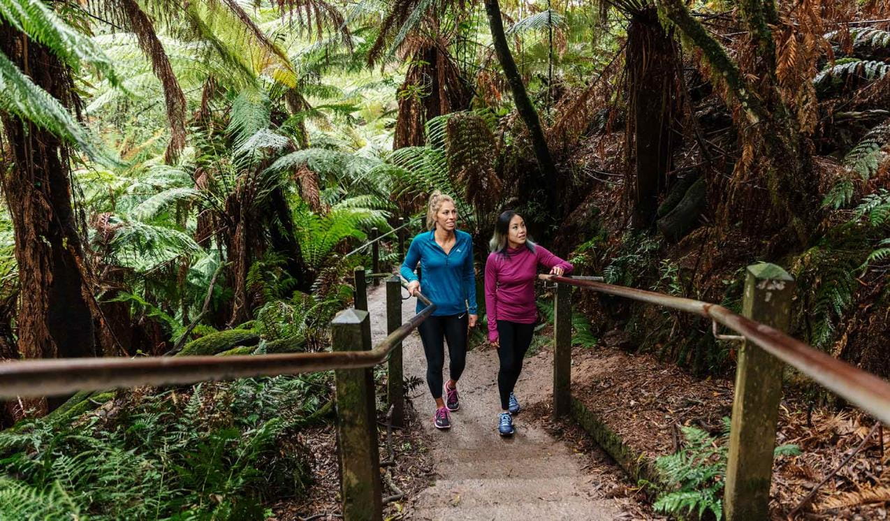
The forested slopes of the Dandenong Ranges are a place of tranquil forest walks, quaint hilltop towns and charismatic animals such as lyrebirds and wallabies. Conquer the famous 1000 Steps, discover Olinda Falls and enjoy commanding views over Melbourne and the Yarra Valley.
The Dandenong Ranges is a rainforest getaway on Melbourne's doorstep. A short drive or train ride from the city you will find steep volcanic hills covered in stands of the world's tallest flowering tree, the Mountain Ash. Living among the greenery are wallabies, lyrebirds, wombats and the Powerful Owl so please ensure you leave your dogs at home to avoid disturbing the local wildlife.
Take an energetic walk up the 1000 Steps from Ferntree Gully Picnic Area and learn about its poignant association with Australia's Second World War veterans and the Kokoda Track Campaign.
The mountains of the Dandenong Ranges offer stunning views across Melbourne. Waterfalls are also a feature of this cool temperate rainforest. Olinda Falls and Sherbrooke Falls are best after rain. Just don't forget to wear hiking boots!

1000 Steps Walk
The 1000 Steps is probably Melbourne’s most popular bushwalk. Officially the Kokoda Track Memorial Walk, runners love the challenge of the steep trail, locals appreciate the convenience and tourists just want a picture of a gorgeous rainforest walk.
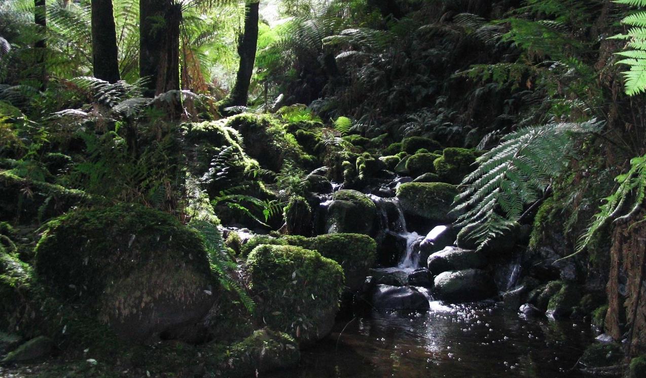
Sherbrooke Falls walk and picnic area
Deep in the Sherbrooke Forest, you'll find Sherbrooke Falls, where little creek cascades into a delightful gully.
When you're there
Download the Dandenong Ranges National Park visitor guide for more information about the park and the plethora of experiences to be had within its borders.
See the Dandenong Ranges National Park map for an overview of the area. For a detailed look, see maps of Doongalla Area, Fern Tree Gully Area, Olinda Area and Sherbrooke Area. Dandenong Ranges maps are also available on Avenza Maps.
Please note, dogs are not allowed in the Dandenong Ranges National Park.
Need to know
Dandenong Ranges National Park
Accessibility
Visiting a park can be more of a challenge for people with disabilities, however in Victoria there are a wide range of facilities to help people of all abilities enjoy our wonderful parks around the state. Grants, O’Donohue, Sherbrooke, One Tree Hill and Ferntree Gully picnic grounds were assessed for accessibility in June 2020, providing information about the accessibility of these areas and photos.
Margaret Lester Forest Walk
TrailRider
Journey among the tallest flowering plants in the world, the Mountain Ash. Picnic with the melodious song of the Superb Lyrebird in the background. Discover rare orchids and marvel at the tree ferns with their link to ancient Gondwanaland. A TrailRider all-terrain wheelchair is the perfect way for park visitors with significant mobility limitations to explore the magnificence of Dandenong Ranges National Park.
Education Excursions
This park offers curriculum-aligned ranger-guided excursions for school students. Download the Education Program to find out more and book your visit.
Assistance Dogs
Assistance dogs are welcome in Parks Victoria parks and reserves. Entry requirements apply for parks and reserves that are usually dog prohibited, such as national parks.
Weddings
While Parks Victoria offers a range of stunning natural landscapes to hold your special day, please note that we do not accept any wedding ceremony or photography bookings in the Dandenong Ranges National Park. Find out more about wedding ceremony and wedding photography and filming permits for other Parks Victoria venues.
Subscribe to Parks Victoria
Sign up to receive the latest ideas, inspiration and news delivered right to your inbox.
Change of Conditions
Nature being nature, sometimes conditions can change at short notice. It’s a good idea to check this page ahead of your visit for any updates.
-
Grants Picnic Ground (Dandenong Ranges National Park)
Bleakley Track closure for upgrade works
As part of the ngurrak barring | RidgeWalk project, Bleakley track that connects Grants Picnic ground to Belgrave will be closed for public safety. These maintenance works will take up to four weeks to complete
Attachments: Bleakley track works update (92KB)
-
Sherbrooke Track (Dandenong Ranges National Park)
Wattle Track Bridge Closure Update
Wattle Track Bridge in Sherbrooke Forest is closed due to significant structural damage to the Foot Bridge by a fallen tree. Parks Victoria has engaged a contractor to commence construction works in March 2024, it is anticipated that the bridge will be opened by May 2024. The existing damaged timber bridge will be replaced with an all steel constructed bridge which includes a non slip FRP decking, during the construction period there may be some delays along Sherbrooke Track as building materials are carried to the site, Sherbrooke track will remain open. -
Olinda Falls Picnic Area (Dandenong Ranges National Park)
Olinda Falls Toilet Closed
The Olinda Falls toilet is closed indefinitely, nearby toilets at Kalorama Park or in the Olinda Township are open.Olinda Falls Lower Viewing Platform - update
The Olinda Falls lower viewing platform is currently closed due to severe damage caused by a fallen tree. All access to the lower falls area is closed to the public. The viewing platform is expected to be replaced sometime in 2024.
Mechanics Track closed between Mt Dandenong Tourist Road and Falls Road
- Mechanics walking track from the Mt Dandenong Tourist Rd through to Falls Rd is closed due to significant damage from the June 2021 Storm. Parks Victoria is currently working with insurance assessors and contractors on a plan to re-open this severely impacted walking track.
- Works completed so far has been the replacement of a timber bridge that was destroyed along with most of the large fallen trees having been cut through, the remaining walking track requires re-benching and tree branch removal where limbs have been partly buried due to the force of the impact with the ground. Works are expected to be completed by June 2024.
-
Valley Picnic Ground (Dandenong Ranges National Park, RJ Hamer Arboretum)
Valley Picnic Ground Closed
- Valley Picnic Ground is closed, the site will eventually be improved after it was damaged in the June 2021 Storm event ; visitors can use Boundary Road to access the park however no vehicle access to the picnic ground carpark is permitted. Please use Eagle Nest or Kalorama Park Picnic Ground as an alternative.
-
Dandenong Ranges National Park
Temporary closed areas due to deer control activities
Parks Victoria are continuing deer control in the Dandenong Ranges National Park. This program will be taking place between the hours of 4pm and 7am on a number of nights between February 13th 2024 and November 29th 2024. These control works are being undertaken by accredited and authorised contractors.For reasons of public safety, various areas of the park will be inaccessible during the evening throughout this period.Signage will be in place at access points when control activities are occurring. For your own safety please observe the signage during this time and do not enter any closed areas.For further information please call 131963Attachments: Neighbour_Notification_Map_DRNP_2324 (2,529KB)
Deer control in the Dandenong Ranges National Park
Parks Victoria are continuing deer control in the Dandenong Ranges National Park. This program will be taking place between the hours of 4pm and 7am on a number of nights between the 1st of November 2023 and the 30th of November 2024. These control works are being undertaken by accredited and authorised contractors.For reasons of public safety, various areas of the park will be inaccessible from dusk until dawn throughout this period.For your safety please observe all closure signage during this time and do not enter any closed areas.For further information please call 131963Attachments: Neighbour_Notification_Map_DRNP_2324 (2,529KB)
Track 13 - Silvan Storm Recovery Works Notification
FFMVic Storm recovery works will take place in the Dandenong Ranges National Park near Silvan.
Date: April to May 2024
Duration: Works will take place from April and are expected to be completed by 30 May 2024, weather and forest conditions permitting
Location: Track 13, near Silvan Reservoir Park, Silvan (see map)
Impact:
Mountain bike and walking tracks in the area will be closed while the works are underway. For your safety, please follow track closures or detours.Tracks closed include:- Bakers Dozen Loop Track
- Downhill Track
- Link Track
- Magpie Loop Track
- Pipeline Track
- Track 11
- Track 12
- Track 24
Why:
FFMVic is continuing to remove fallen debris along key fire access roads and fuel breaks to make the Dandenong Ranges National Park safer for everyone. It’s important to undertake maintenance of the strategic fuel break network to reduce the rate of spread of bushfires and provide vital protection for communities.
This block sits within a Bushfire Moderation Zone, which aims to reduce the intensity, rate of spread, and ember loads from significant bushfires.
The protection of environmental, biodiversity and cultural values during all recovery and bushfire risk reduction works are a high priority.For more information about bushfire risk reduction activities visit the FFMVic website or call 136 186.Attachments: FFMVic Track Closure Map (554KB)
- Bakers Dozen Loop Track
Tours and adventure experiences in parks
One of the best ways you can get into nature is with a Licensed Tour Operator.
There are more than 400 Licensed Tour Operators across Victoria who are ready and waiting to help you experience and connect with Victoria’s spectacular parks and waterways.
Discover more than 60 different types of nature-based experiences including hiking, mountain biking, boating, four-wheel driving, indigenous culture tours, birdwatching, surfing, diving and so much more.
Licensed Tour Operators know all the best places to go and will plan and prepare your visit to ensure you are safe and can enjoy your nature-based adventure to the fullest.
How we keep it special
We aim to ensure that our valued parks, and the natural assets and cultural heritage they hold, can be enjoyed now and by future generations.