Explore
Great Otway National Park
Great Otway National Park stretches from Torquay, along the world-famous Great Ocean Road and up through the Otways hinterland. Discover windswept coastlines and breathtaking waterfalls in tall mountain forests, walk the iconic Great Ocean Walk, immerse yourself in the Otway Lightstation's history, or surf some of the best breaks in Australia. Enjoy the great outdoors and explore the wonders of the Great Otway National Park.
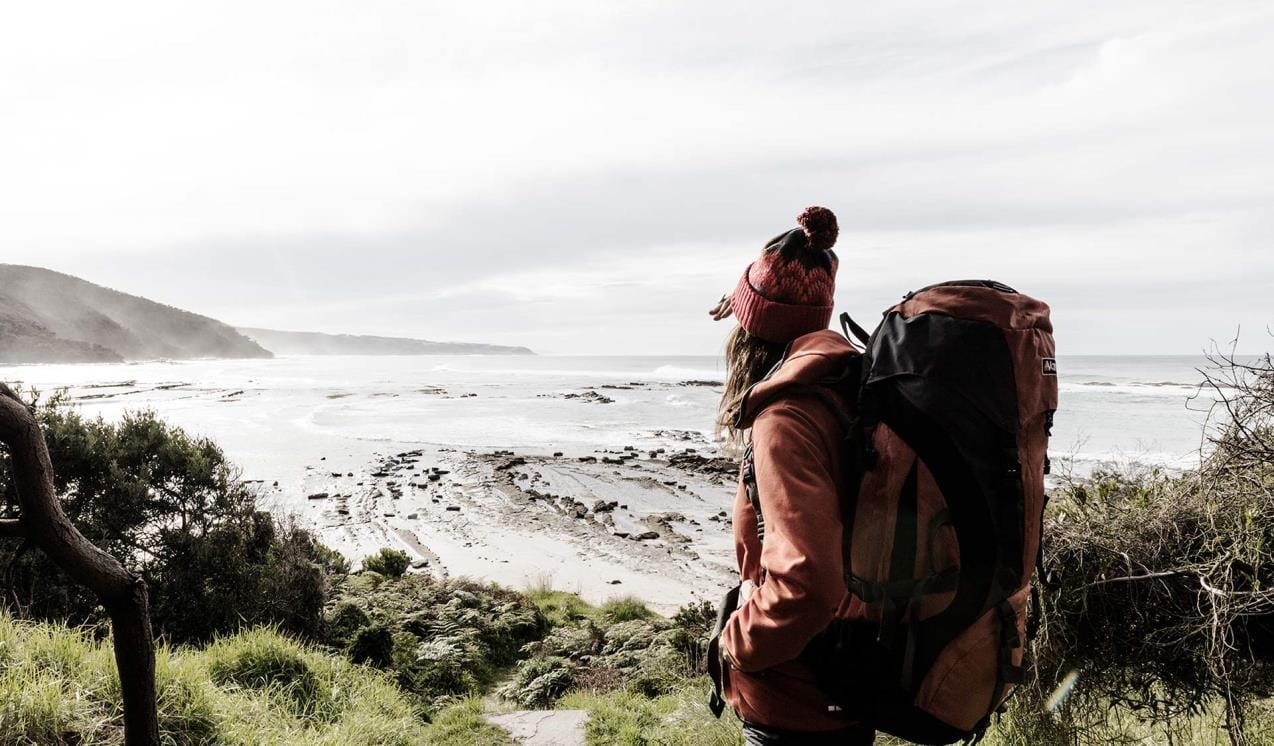
See the stunning coast between Apollo Bay and the Twelve Apostles by foot on the Great Ocean Walk, where nature unfolds at every step. Do the whole walk in eight days or tackle it in sections on weekends away. Immerse yourself in nature by walking the Surf Coast Walk over 44km from Torquay to Aireys Inlet.
Or drive the iconic Great Ocean Road. Built by soldiers recently returned from World War 1, it is the world’s longest war memorial.
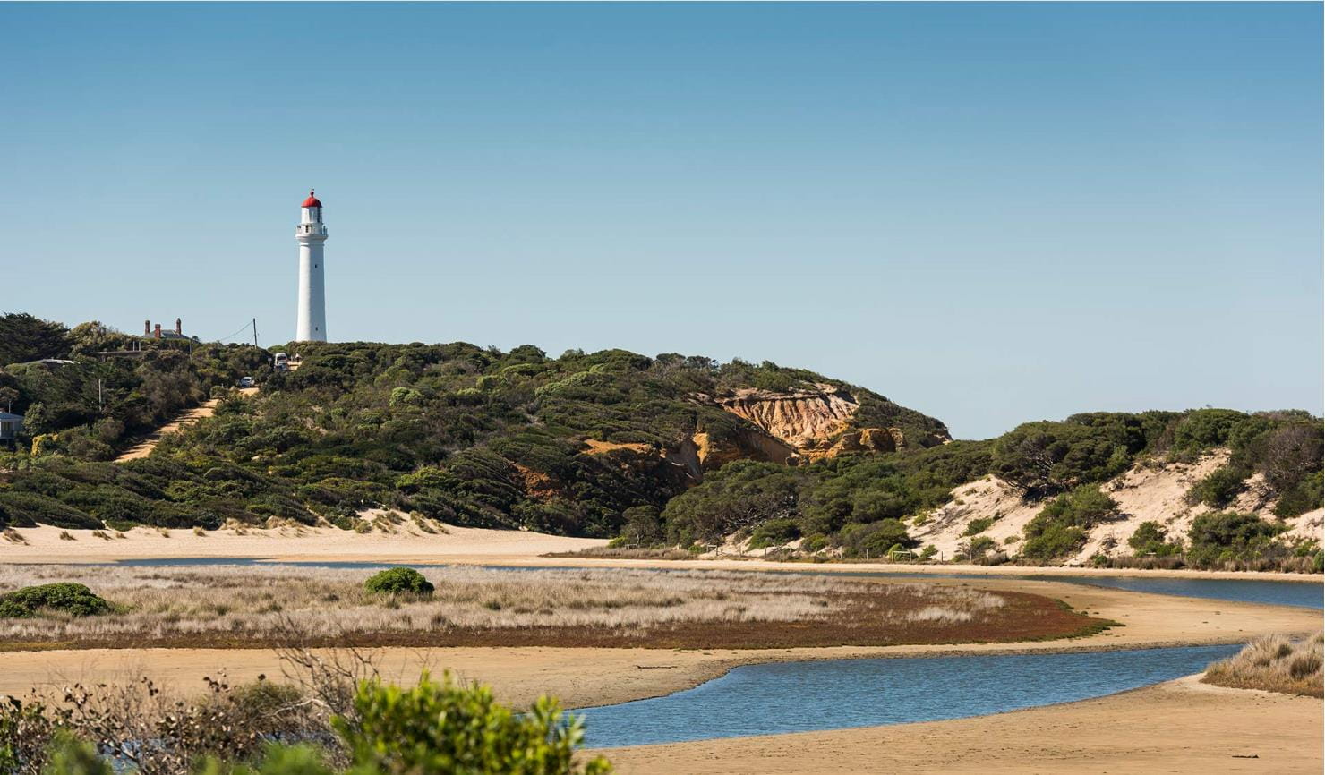
Take a tour and discover the colourful maritime history of the Cape Otway Lightstation. Climb to the top of the historic lighthouse for dramatic views of the so-called Shipwreck Coast.
Surf the thunderous beach breaks off Johanna Beach and discover the fascinating underwater mini-ecosystems of rockpools in the Eagle Rock Marine Sanctuary at Aireys Inlet or the sandy shores and rock platforms along the Great Ocean Road.
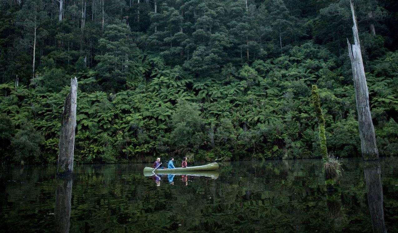
Ride through tall eucalypt forests, dry heathy scrub and dense fern gullies along the Forrest Mountain Bike Trails in the nearby Otway Forest Park, or simply relax among the eucalyptus trees and have a picnic at the Sheoak Picnic ground near Lorne.
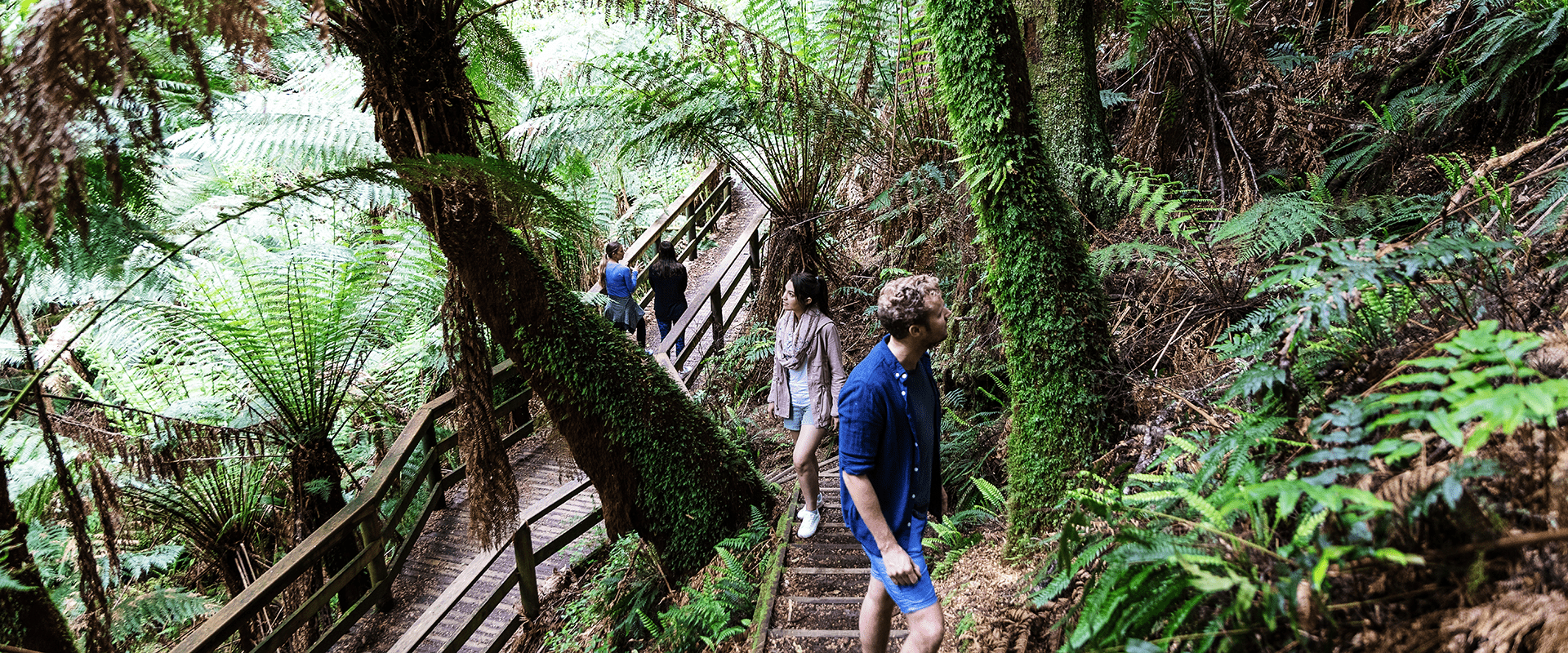
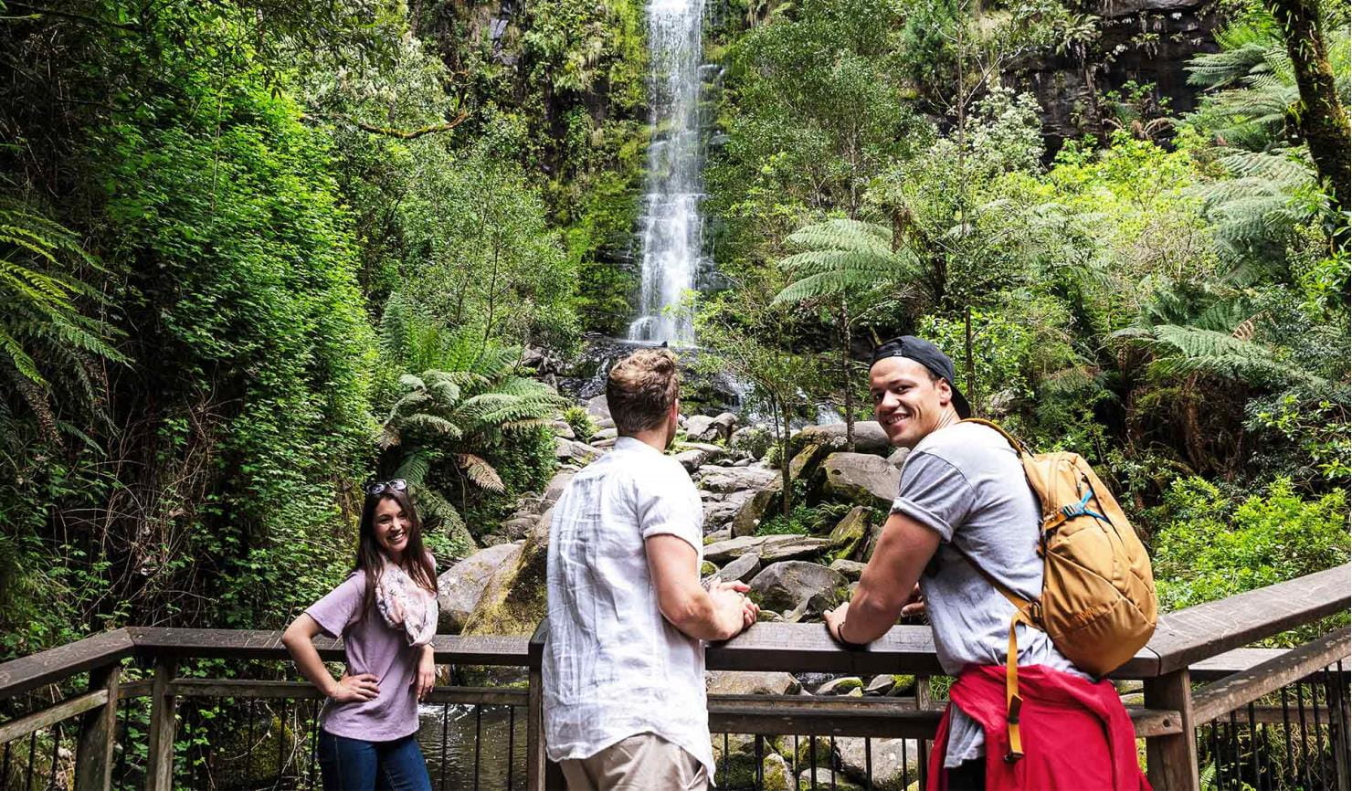
Traverse fern-laden valleys to discover picture-perfect waterfalls such as Erskine Falls, Sheoak Falls, Triplet Falls, Hopetoun Falls and Kalimna Falls.
Walk through the mossy forest of Melba Gully and witness the unique night-time spectacle of glow worms.
Visit Maits Rest to discover gorgeous fern gullies or the giant beech trees – some of which are up to 300 years old and walk among the towering Californian Redwoods hidden in the Otway Ranges.
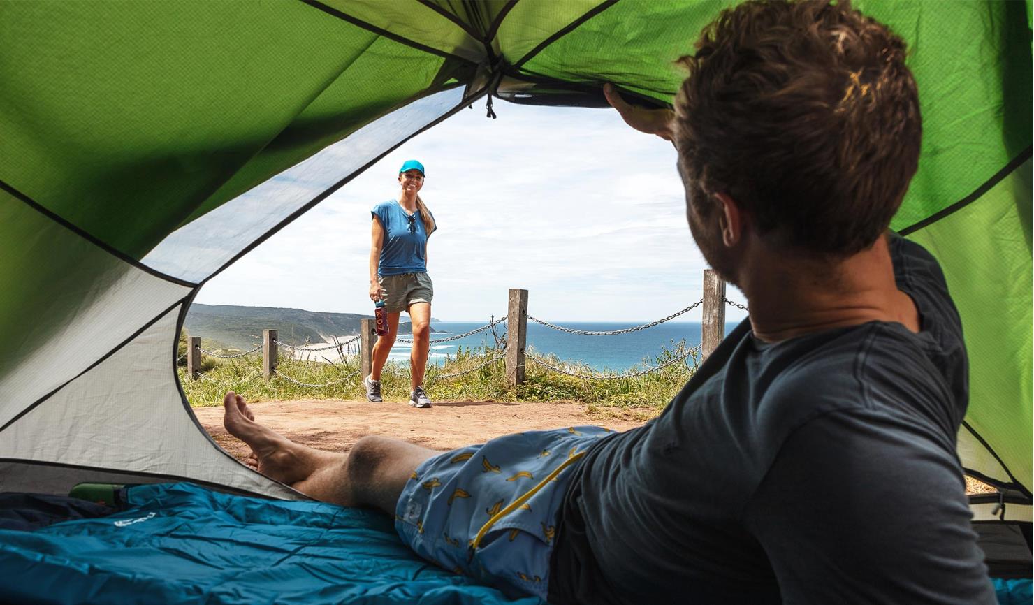
For longer stays, there are excellent camping opportunities whether you are looking for a family-friendly place to park your caravan or a solitary night under the stars.
As beaches and coasts are natural environments, you may encounter hazards. Follow our water safety advice to make sure your day out at Great Otway National Park is a safe and enjoyable one.
Forrest
The Forrest section of Great Otway National Park, along with Otway Forest Park, encompasses a stunning landscape including undulating plains and plateaus of the hinterlands and magnificent Mountain Ash forests.
Great Ocean Walk
The Great Ocean Walk is a one-way, long-distance walk extending just over 110km. This once-in-a-lifetime hike will take you eight days.
Great Otway National Park
Explore the different areas
Explore all of the different areas within the Great Otway National Park.
When you're there
Need to know
Great Otway National Park
Accessibility
The Colac Otway Shire and Surf Coast Shire each have an all-terrain wheelchair, called a Trailrider, that is available for park visitors with mobility difficulties. The chairs can be booked with the respective shires.
Assistance dogs are welcome in Parks Victoria parks and reserves. Entry requirements apply for parks and reserves that are usually dog prohibited, such as national parks.
Safety
Rock fishing is a great way to enjoy the great outdoors, but it’s also risky. See our water safety page and follow safety precautions around water to make sure your visit is safe and enjoyable.
Subscribe to Parks Victoria
Sign up to receive the latest ideas, inspiration and news delivered right to your inbox.
Change of Conditions
Nature being nature, sometimes conditions can change at short notice. It’s a good idea to check this page ahead of your visit for any updates.
-
Lemonade Creek Walk (Great Otway National Park)
Lemonade Creek Walking Track Closure
Due to multiple unsafe bridges the Lemonade Creek Walking Track will be closed indeffinately -
O'Donohue Beach Access (Great Otway National Park)
O'Donohues Beach access
Beach access from O'Donohues Carpark is closed from 24th April to 24th May,2024. Due to recent dune movement the staircase is currently unsafe. Alternative beach access is available 400m east at Melba Pde or 400m west at The Gap. -
Great Otway National Park
Delayneys Track Closed
Delayneys Track is closed until further notice.
Wye Road Closure
Wye Road is temporarily closed for grading and landslip repair.Temporary park closures Great Otway National Park
Sections of the Great Otway National Park will be temporarily closed at night from Monday 15th April 2024 through to June 1st 2024 to allow for the safe delivery of park conservation work. Temporary closed areas will be clearly sign posted. All campgrounds will remain open during this operation. For further information please contact Parks Victoria on 13 19 63 or email westregiondcp@parks.vic.gov.au -
Other issues
Sharps Campground permanently closed
Permanently closed due to environmental and safety risks. -
Aire Crossing Campground (Aire River Heritage River, Great Otway National Park)
Youngs Creek Track Closed Great Otway National Park
Following recent rainfall and current conditions, Youngs Creek track within the Great Otway National Park is currently closed.Safety for our visitors and protection of the environment has led to this decision. The nearby Triplet Falls and Aire Crossing visitor sites remain open along with the tracks leading to them. -
Jamieson Creek (Great Otway National Park)
Wye Road Temporary Closure
Wye Road will be closed temporarily for grading and landslip repair. -
Notices Affecting Multiple Sites
Please take your rubbish home
Reminder to campers and visitors to please take your rubbish home. Please do not put rubbish in toilets. Visitors have been placing rubbish in the pit toilets making human waste removal difficult. Parks appreciates your assistance in looking after the Park. -
Blanket Bay Day Visitor Area (Great Otway National Park)
Blanket Bay Campground- water supply
Blanket Bay campground in Great Otway National Park water supply is very low. Campers are advised to bring their own water. -
Melba Gully Day Visitor Area (Great Otway National Park)
Melba Gully - Large bus access
Melba Gully Walk Track and picnic area is accessible for large coaches. Toilet facilities are available on site -
Maits Rest Rainforest Walk (Great Otway National Park)
Maits Rest Carpark- bus access
Maits Rest Carpark is suitable for small coaster buses only. Large buses or coaches are advised to use Melba Gully walk track near Lavers Hill.
Tours and adventure experiences in parks
One of the best ways you can get into nature is with a Licensed Tour Operator.
There are more than 400 Licensed Tour Operators across Victoria who are ready and waiting to help you experience and connect with Victoria’s spectacular parks and waterways.
Discover more than 60 different types of nature-based experiences including hiking, mountain biking, boating, four-wheel driving, indigenous culture tours, birdwatching, surfing, diving and so much more.
Licensed Tour Operators know all the best places to go and will plan and prepare your visit to ensure you are safe and can enjoy your nature-based adventure to the fullest.
How we keep it special
The Great Otway National Park and Otway Forest Park Management Plan was first published in December 2009 and amended in November 2019.
The Great Otway Parks Conservation Action Plan provides directions for environmental conservation management across the diverse landscape, including Great Otway National Park. This covers the old-growth forests, cool temperate rainforests and wet forest, heathlands, coastline and marine ecosystems.
Bellarine and Great Ocean Road Dunecare project
Coastal dunes form a unique and highly diverse ecosystem. They play an important part in the health of our coastlines, protecting them from sea surges and storms that can impact infrastructure and livelihoods. Parks Victoria received over $124k in funding as part of the Bellarine and Great Ocean Road Dunecare Project to improve habitat conditions for native animals and reduce the impacts of human-induced erosion.