Explore
Kinglake National Park
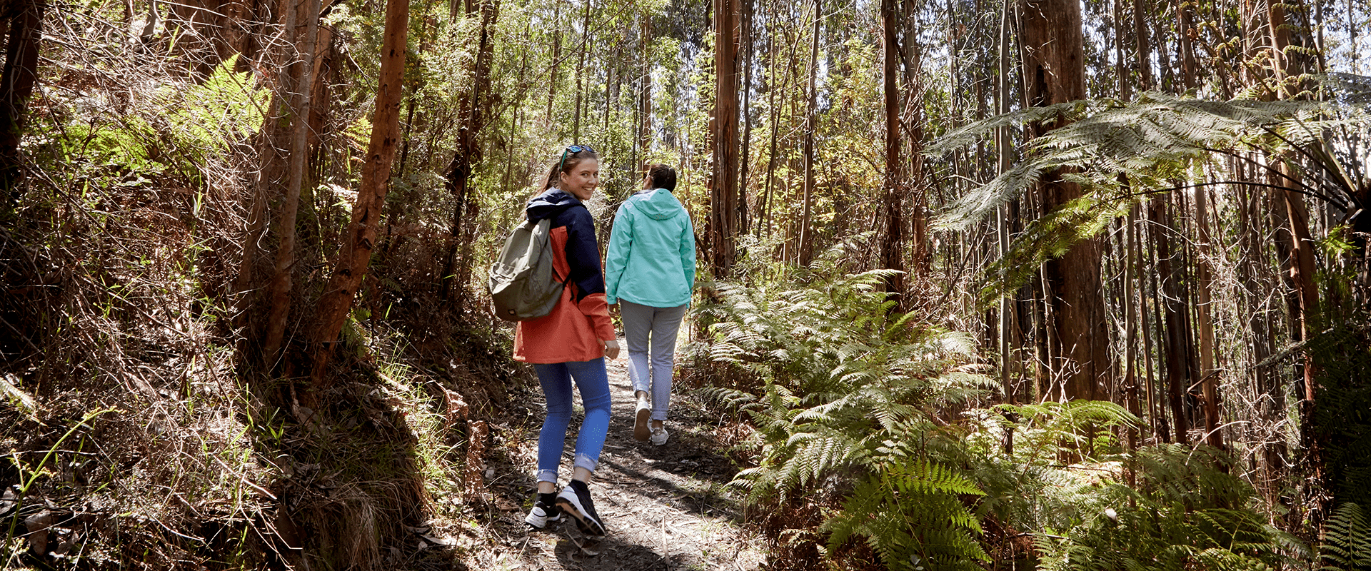
Kinglake National Park lies on the slopes of the Great Dividing Range, a short drive from Melbourne. Enjoy scenic walks, thrilling mountain bike trails and picnics against the backdrop of panoramic views of the city, Port Phillip Bay, the Yarra Valley and across to the You Yangs.
The park is home to a variety of native birds. Keep an eye out for Sulphur-crested Cockatoos, lyrebirds, King Parrots and colourful rosellas. Go mountain biking at Bowden Spur. The diverse and technical downhill trail offers dirt jumps, rock gardens, bomb holes, flowing earth berms and large sections of off‐camber riding. Drive up to Mount Sugarloaf for panoramas out over Melbourne’s skyline.
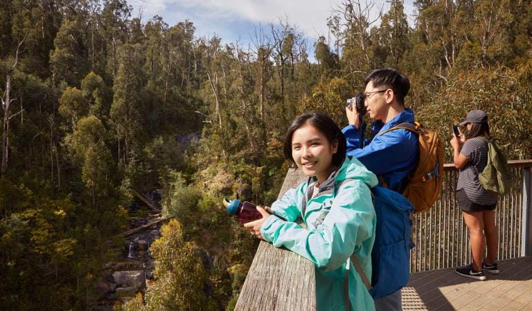
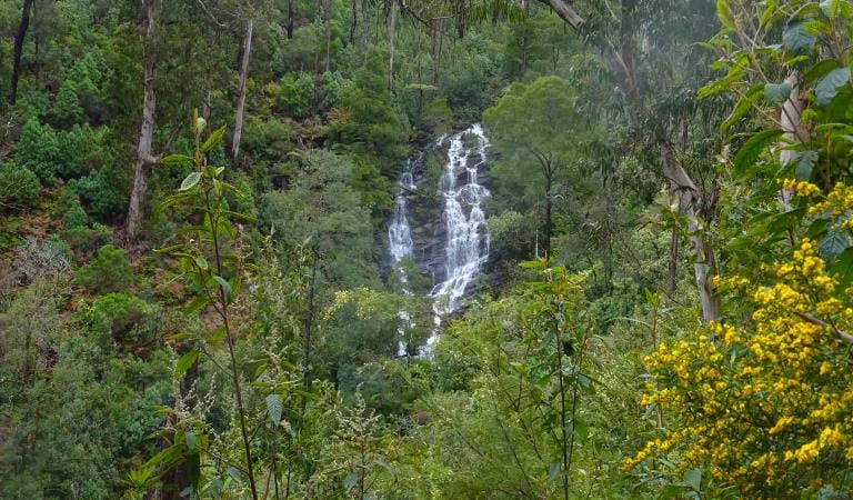
Enjoy a picnic or barbecue in the surrounds of tall eucalypts before embarking on a short walk to Masons Falls. See water cascading over the sheer mudstone walls, which are fossilised sea beds.
The Gums Camping area is nestled among tall eucalyptus forest and by a tranquil mountain stream. Camp or bring your caravan or camper for a comfortable stay.
Things To Do
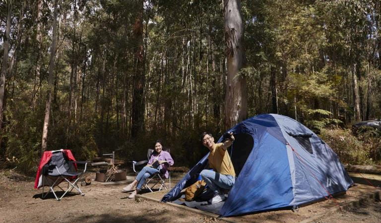
The Gums Camping
Masons Falls
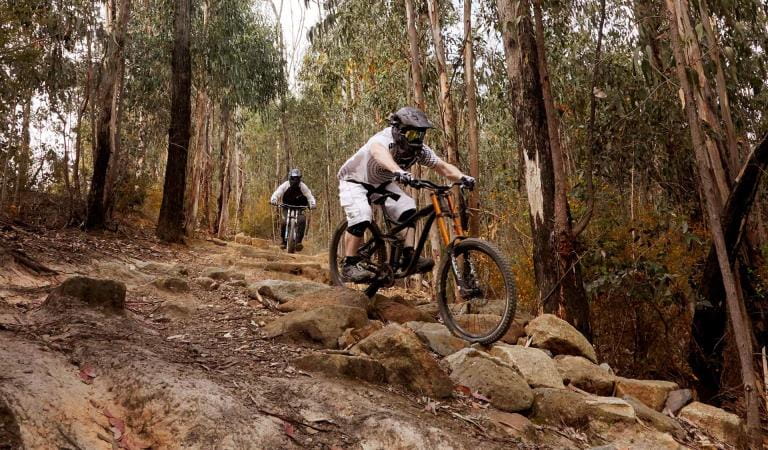
Bowden Spur Mountain Bike Area

Jehosaphat Gully
Wombelano Falls
Frank Thomson Reserve
Mount Sugarloaf
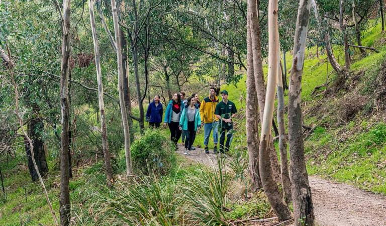
Guided Park Walks
Kinglake National Park
Kinglake is home to many rare species that were once common in the Yarra Valley, now part of the greater Melbourne metropolitan area. The following species have all been identified as being 'significant' within Kinglake National Park.Tours and adventure experiences in parks
One of the best ways you can get into nature is with a Licensed Tour Operator.
There are more than 400 Licensed Tour Operators across Victoria who are ready and waiting to help you experience and connect with Victoria’s spectacular parks and waterways.
Discover more than 60 different types of nature-based experiences including hiking, mountain biking, boating, four-wheel driving, indigenous culture tours, birdwatching, surfing, diving and so much more.
Licensed Tour Operators know all the best places to go and will plan and prepare your visit to ensure you are safe and can enjoy your nature-based adventure to the fullest.
How to get there
Kinglake National Park
When you're there
Kinglake National Park protects almost 600 native plant species, over 40 native mammal and 90 native bird species.
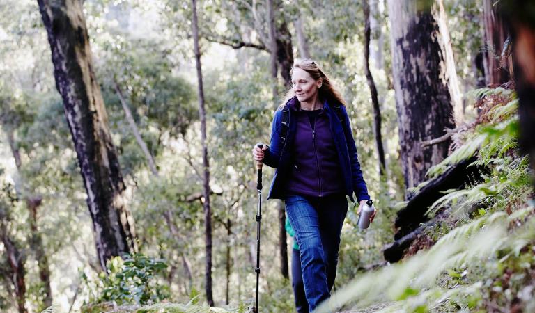
Bushwalking, picnics, camping, horse riding, cycling and nature study are all popular activities in the park. In spring, keep an eye out for wildflowers in bloom. Winter is a good time to discover fungi, mosses and lichens.
Horse riding is permitted only on Old Kinglake Rd, Everard Track and Watsons Creek Track. It is prohibited in the rest of the park.
If you are visiting the Everard Block, which takes in Jehosaphat Gully and surrounding walks, take care not to stray from the marked trails. The area is littered with mine shafts. Most of them remain unmapped to date.
Some areas of Kinglake National Park are closed on Catastrophic Fire Danger days. On high fire danger days it is advisable not to the enter the park.
When to go
Longer days and nicer weather allows more time to explore all that Kinglake National Park has to offer.
Due to the higher elevation of Kinglake National Park, it is a great place to escape the heat of summer. It is usually about 2 degrees cooler than the region's lower lying areas.
Need to know
Kinglake National Park
Accessibility
The Lyrebird Circuit Walk at Masons Falls is 500m long and specifically designed for people with limited mobility. The shady trail winds its way around some of the park's oldest trees.
Assistance dogs are welcome in Parks Victoria parks and reserves. Entry requirements apply for parks and reserves that are usually dog prohibited, such as national parks.
Trailrider
People of all abilities can now enjoy the beautiful sights and sounds of Kinglake National Park alongside family and friends with the help of a TrailRider all-terrain wheelchair.
Journey through the tall eucalypt forests of Kinglake National Park, situated within the Great Dividing Range, only 65km’s north-east of Melbourne. Explore a network of walking trails through fern gullies leading to cascading falls or take in sweeping views across rolling hills towards Port Phillip Bay.
TrailRider is the perfect way for park visitors with significant mobility limitations to explore the magnificence of Kinglake National Park.
Change of Conditions
Nature being nature, sometimes conditions can change at short notice. It’s a good idea to check this page ahead of your visit for any updates.
-
The Gums Campground (Kinglake National Park)
Barbecues Closed
The Gums Campground barbecues are out of order and will remain closed until further notice. -
Toorourrong Reservoir Park (Kinglake National Park, Toorourrong Reservoir Park)
Toorourrong Reservior Park gate losure - Pedestrian Access Only
Due to an ongoing fault with the entrance gate at Toorourrong Reservior Park, there will be no vehicle access into the park until repairs can be completed.Pedestrian access is still permittedFor further information please contact 13 19 63
How we keep it special
The Management Plan for Kinglake National Park directs all aspects of management of the Park until the Plan is reviewed.
The Master Plan, released in 2011, provides a framework for visitor use, facilities and infrastructure in Kinglake National Park over the next 15 years.
Over 96 per cent of the park was burnt during the February 2009 fires, however nature has recovered and the park is now lush, green and filled with life.