Explore
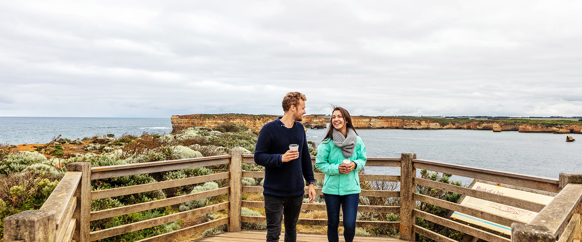
Port Campbell National Park
The wild Southern Ocean has carved the Port Campbell National Park coastline into formations that are famous the world over - and earned it the nickname of the Shipwreck Coast. Drive the Great Ocean Road and see London Bridge, The Grotto, Loch Ard Gorge and the unmissable Twelve Apostles.
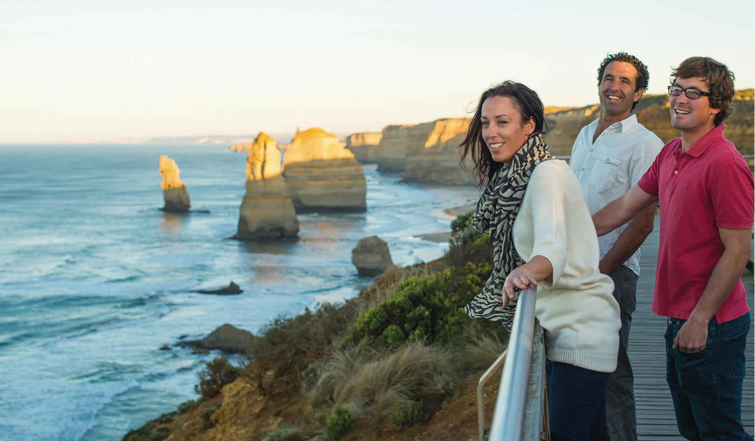
The best way to see Port Campbell National Park is to take the Great Ocean Road. This is one of the world's most celebrated scenic drives – and its undoubted highlight is the Twelve Apostles, which tower 45 metres above the Southern Ocean.
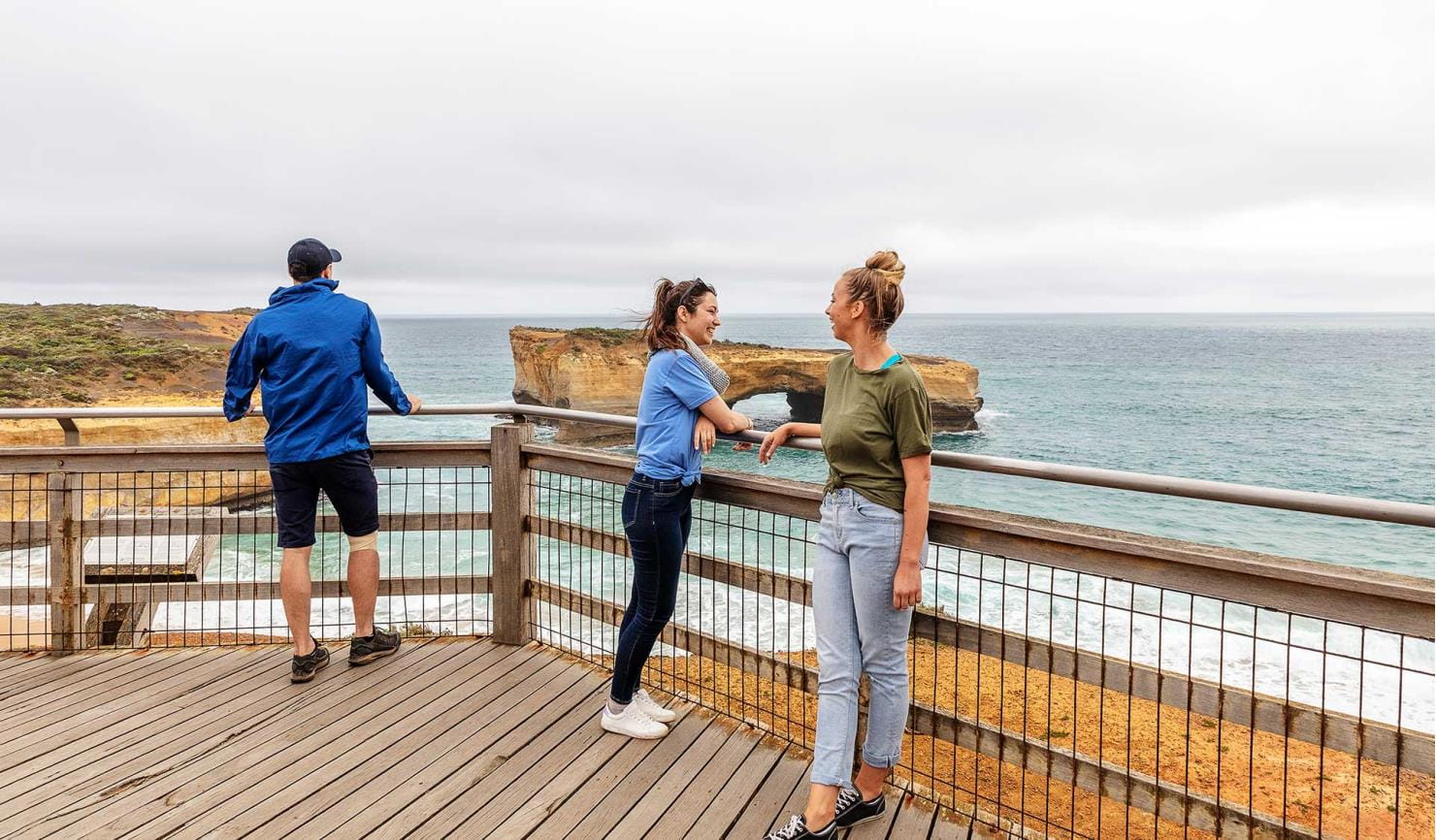
On a coastline renowned for its spectacular coastal formations it’s easy to overlook London Bridge and The Grotto, which are both as awesome in their own way as the more famous Twelve Apostles.
Port Campbell National Park is also home to animals that carve out a niche on this inhospitable coastline. At dusk, they come home from their feeding grounds out at sea. Look down at the Twelve Apostles or London Bridge and you can see Little Penguins. Or check out the natural wonder of thousands of Short-tailed Shearwaters returning to roost on Muttonbird Island (near Loch Ard Gorge) at sunset. Whales are also a common sight along the coast and Port Campbell township is a good lookout to spot them from.
As beaches and coasts are natural environments, you may encounter hazards. Follow our water safety advice to make sure your day out at Port Campbell National Park is a safe and enjoyable one.
Top places
Tours and adventure experiences in parks
One of the best ways you can get into nature is with a Licensed Tour Operator.
There are more than 400 Licensed Tour Operators across Victoria who are ready and waiting to help you experience and connect with Victoria’s spectacular parks and waterways.
Discover more than 60 different types of nature-based experiences including hiking, mountain biking, boating, four-wheel driving, indigenous culture tours, birdwatching, surfing, diving and so much more.
Licensed Tour Operators know all the best places to go and will plan and prepare your visit to ensure you are safe and can enjoy your nature-based adventure to the fullest.
How to get there
Port Campbell National Park
Every evening between September and April, thousands of Short-tailed Shearwaters - a seabird - return to Mutton Bird Island to roost in burrows and feed their young. This is an astonishing natural event that every wildlife lover should witness.
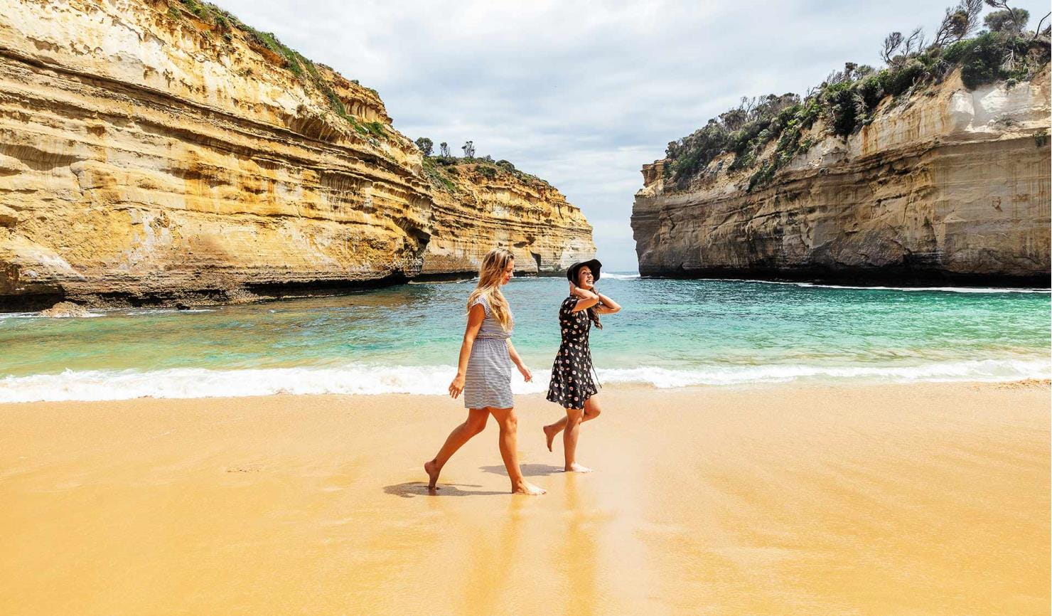
From Loch Ard Gorge carpark, walk to the end of the Living on the Edge trail to Sherbrook Beach. It's not safe to swim here, but it's a beautiful and secluded place to linger for a while.
When you're there
When to go
Take a dip in Port Campbell Bay. The beach is patrolled during summer and it is the only safe place to swim along this stretch of coast.
Need to know
Port Campbell National Park
Accessibility
Visiting a park can be more of a challenge for people with disabilities, however in Victoria there are a wide range of facilities to help people of all abilities enjoy our wonderful parks around the state.
To make it easier for people with limited mobility to see the all abilities access and experiences on offer at Twelve Apostles and Loch Ard Gorge walks, Parks Victoria has released this video - produced and narrated by accessibility advocate Ryan Smith, who uses a wheelchair.
Two beach wheelchairs are available for visitor use at Port Campbell beach. These chairs are owned and managed by the Port Campbell Surf Lifesaving Club. Visit the Corangamite Shire website for further information and chair bookings.
Assistance dogs are welcome in Parks Victoria parks and reserves. Entry requirements apply for parks and reserves that are usually dog prohibited, such as national parks.
Tread lightly as the coast is fragile and your safety matters. Stick to marked trails to avoid injury, and to protect the delicate coastal vegetation and wildlife that call the park home.
Change of Conditions
Nature being nature, sometimes conditions can change at short notice. It’s a good idea to check this page ahead of your visit for any updates.
-
Loch Ard Gorge (Port Campbell National Park)
Reduced access to Loch Ard Gorge visitor areas
Loch Ard Gorge beach access closedBeach access is closed due to dangerous cliff movement near the Upper Lookout, which could cause a collapse. Geotechnical specialists have assessed the site and we will continue to work through the permits required to protect the significant cultural and environmental values of Loch Ard before we start work to restore access to the beach.This work is complex and will take time. Parks Victoria will provide updates and indicative timelines once we have further information.Closed walking tracks and reduced carparking - The Blowhole, Thunder Cave, Sherbrook RiverConstruction of a new lookout at The Blowhole will commence in January 2024, creating a stunning new visitor attraction for the Loch Ard Gorge precinct. The project is expected to take 12 months, subject to on-ground and construction industry conditions.
To ensure public safety during construction, access to some tracks and areas around The Blowhole will be closed, including no access to Thunder Cave and Sherbrook River. There will also be a reduction in the number of carparking spaces available for the public at the Loch Ard Gorge precinct, and no parking near Sherbrook River. Turning circles will also be restricted due to the construction works. Caravans and other long vehicles will be required to park in the Loch Ard Gorge car park. -
Twelve Apostles (Port Campbell National Park)
Saddle Lookout - access change
From mid-September 2021 there will be no access to the Saddle and Castle Rock viewing areas while a new lookout is being built.
Visitors can continue to enjoy the other lookouts, boardwalks and visitor areas at the Twelve Apostles and the other spectacular visitor sites in the Port Campbell National Park.For more information https://www.parks.vic.gov.au/projects/western-victoria/saddle-lookout
How we keep it special
The Port Campbell National Park and Bay of Islands Coastal Park Management Plan directs aspects of management across the park.
The Great Otway Parks Conservation Action Plan provides directions for environmental conservation management across the diverse landscape, including Port Campbell National Park. This covers the old-growth forests, cool temperate rainforests and wet forest, heathlands, coastline and marine ecosystems.
Saddle Lookout
A key project in Stage One of the Shipwreck Coast Master Plan is developing the ‘Saddle Lookout’ at the Twelve Apostles visitor precinct. The new lookout will replace existing viewing areas that no longer cater for visitor numbers, providing a superior, safer and more accessible experience. Learn more about the Saddle Lookout project.
Blowhole Lookout
A new lookout is being created at Loch Ard Gorge, providing new views of ‘The Blowhole’ – a deep cutting in the land that fills with rushing water when tides are high. Learn more about the Blowhole Lookout project.